I was so excited to begin our big late summer adventure. It occurred to me that we had been planning this trip since February. It began in Derek and Mari's dining room in Miami when we got our Glacier National Park campsite reservations. We were online and ready six months to the second and missed the first one we tried. Luckily, we got a spot in the Fish Creek Campground. We had to play what I call the “National Park Game” on many occasions during this trip since high visitation in popular locations often requires special reservations and passes.
Our route took us north along the upper Mississippi River, through Minnesota and North Dakota to Glacier National Park. It was the second big trip in our new camper van (see Sauntering Through the Appalachian Mountains), but this time we had a new trailer hauling our Triumph Tiger motorcycle behind. It pulled easily but did add a new length challenge when parking and camping. We followed our usual travel pattern, driving 6-8 hours most days and often stopping for long lunch breaks at parks along the way.
 |
| Figure 1. Rig ready for travel. |
On day one (August 8, 2024) we drove to Pikes Peak State Park in Iowa where we stayed a few months prior. On the way, we stopped for lunch in a Bellevue, Iowa riverside park along a Mississippi River lock and dam. The park had a walkway with fancy pavers, statues, gazebos, and benches.
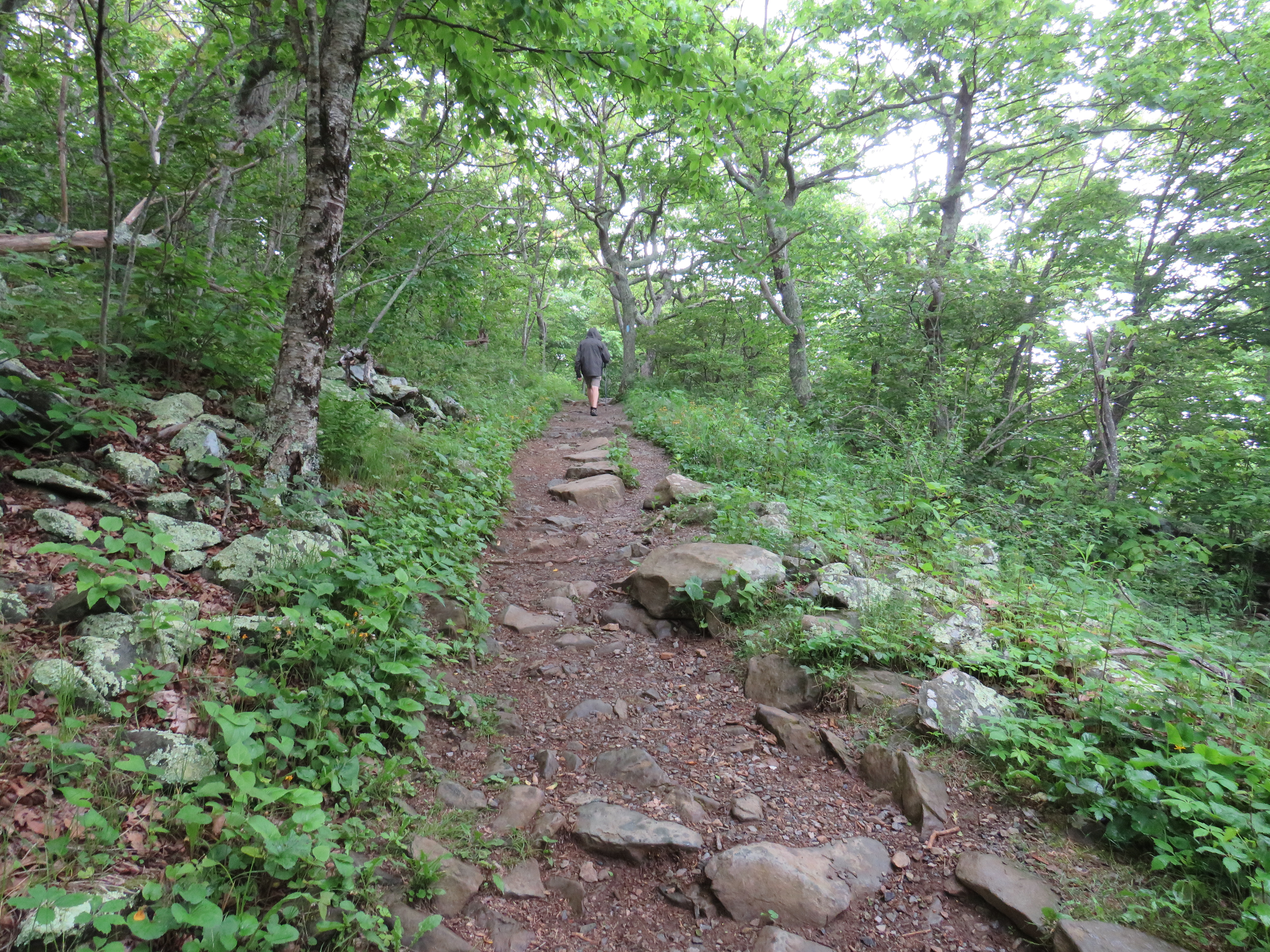
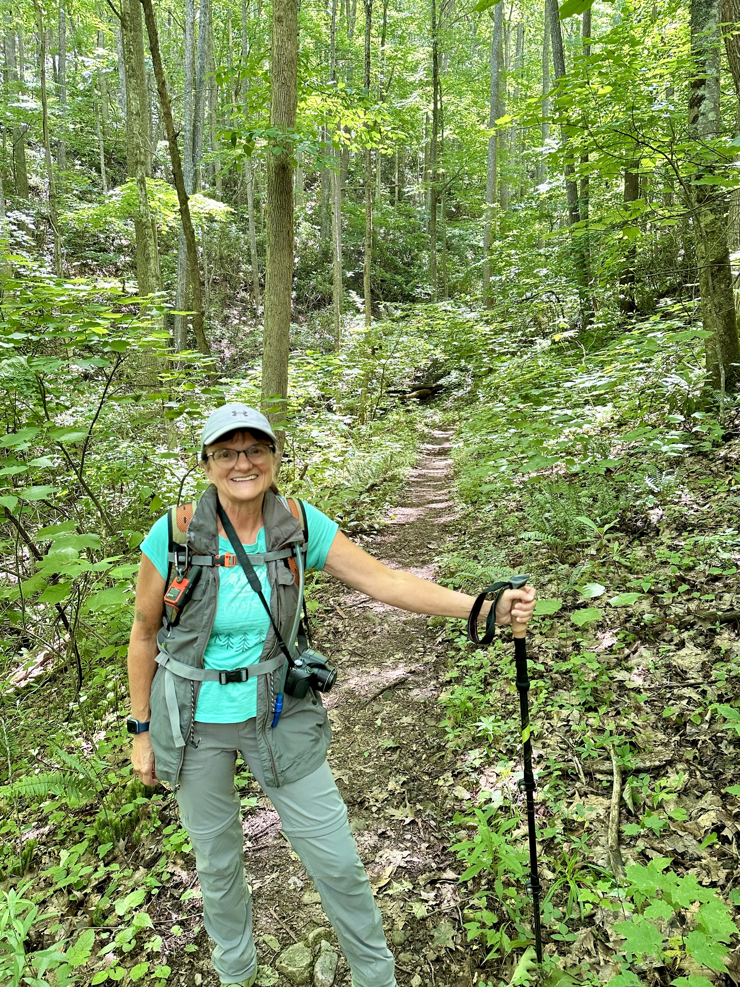
The second day we stopped at Frontenac State Park near Red Wing, Minnesota for a lunch break on the way to visit my cousin near St. Paul. There, I fixed grilled cheese in the van, and we went for a two-mile hike on the Upper Bluff Side Trail to In Yan Teopa Rock (Hole-in-the-rock). Apparently, the Mississippi is at its widest at that point, forming Lake Peppin (where Laura Ingalls Wilder was born). The park brochure said it was one of the best places in the country to view bird migrations. I doubted that since we have so many in Central Illinois too, though we did see many birds including indigo bunting, hummingbird, bald eagle, oriole, and downy woodpecker. We heard other interesting birds as well. The trail ran along a bluff through a wooded area with mostly sugar maples and an occasional large basswood. There was one small patch of ferns, but otherwise the understory has either bare soil or small maple and ash trees.
 |
| Figure 2. Frontenac State Park trail. |
We arrived at my cousin’s home midafternoon where we stayed one night. We had such a fun time there playing with their five fantastic kids and catching up on our lives. What a great visit with a wonderful family that we hope to see more often.
North Dakota
From there we traveled northwest for our first visit to North Dakota (my 40th state). We found it was a state of agriculture and prairies, with many small lakes. We had a camping site reserved at Fort Abraham Lincoln State Park and arrived midafternoon. Our site 104 was primitive (without electric or water) and was adjacent to the wide Missouri river. I was driving when we got there, so I backed our little moto-trailer into the site. It was my first time backing this rig, and it was quite easy (though I have extensive experience backing trailers).
Soon, I was sitting under a cluster of ash trees next to a large patch of aromatic sumac. Pontoons and jet skis lined the riverbank across from us where many people enjoyed a perfect summer Saturday on the river. We knew it was the same river that Lewis and Clark adventured on, but we soon learned that there was much more history there.
The next morning, we sat by the river in the sun drinking coffee. It was such a pleasant morning looking out over the river. Sun sparkled on the water, creating sparkling diamonds when the surface was disrupted by a fish or something. We watched crows and swallows fly around. Turtles or something was working the surface in one area. A family was up fishing early with their poles and holders stationed every five feet or so along the bank. Each had a bell at the tip, though I never heard any ring or saw any fish caught. They sure tried though.
 |
| Figure 3. Morning coffee at Fort Abraham Lincoln State Park. |
After breakfast we walked to the visitor center, which was exceptional, especially for a State Park. It explained the historical changes along the river from native Mandan village to Infantry fort to the Calvary fort where Custer ruled before he was killed at the battle of Little Big Horn. Seeing these places brings a sense of reality to the old history stories. We watched a movie there too. I was intrigued by the display on CCC after recently learning my great grandfather worked for CCC in Illinois. They rebuilt the forts and the On-a-Slant Mandan village lodges. We walked through a few of the lodges that were open and were impressed with their unique construction and functionality. What a great state park.
 |
| Figure 4. On-a-Slant Mandan Village at Fort Abraham Lincoln State Park. |
We planned to visit many National Park on this almost 30-day trip. The first one was Theodore Roosevelt National Park, which was only 2 ½ hours from the State Park where we stayed. North Dakota reminded us of Kansas and South Dakota until we reached the Badlands of this park. It is an area with deep crevices and steep whitish rocks. Some of it was Grand Canyon-like on a smaller scale with different colors. Our reservation was in the Cottonwood campground in site 39, which was adequate, but not great. It was a pullover site, barely off the road, with a picnic area down a short path. There was a picnic table and a stand-up grill, but no ground firepits in that park.
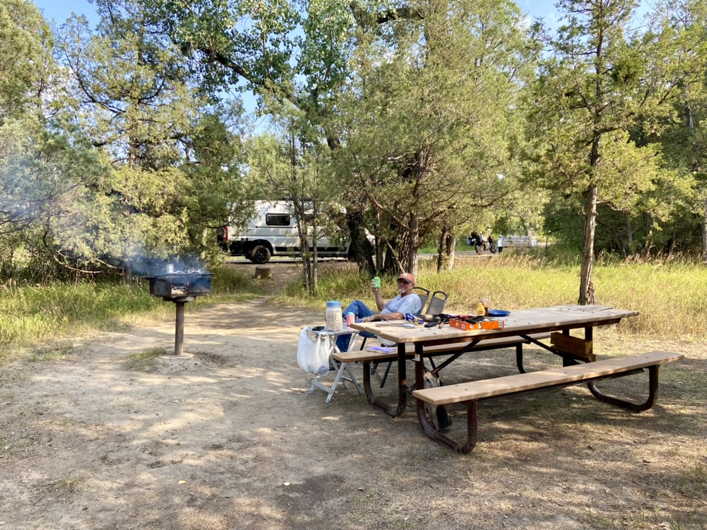 |
| Figure 5. Grilling at campsite in Theodore Roosevelt National Park. |
We unloaded the bike, moving the trailer to the end of the pullout, then had lunch in our van. Cloudy skies threatened rain, so we drove the van to the visitor center near our campground along the park’s south unit scenic road. A prairie dog village pull-off always had the most visitors along that road. At the visitor center a ranger gave us a couple hiking suggestions.
Rain was uncertain so we decided to hike anyway. We drove to the Peaceful Valley Ranch and put on hiking gear. The ranger warned us that we had to cross the Little Missouri River to start the trail. It was mostly shallow, but as was we walked up and down to find the best crossing location, there was always a deeper, quick flowing portion that made crossing difficult. Mark put a nearby log over one section and I started across with one trekking pole, then Mark gave me his, however I still felt unstable, standing in the water, barely above it, ready to topple in at any moment, with a camera around my neck. So, we decided to take off our shoes and socks and wade across. That worked well as long as we stayed off the larger slippery rocks and stayed in the pebbles at the bottom. On the other side, we put it all back on and continued down a narrow trail.
At an intersection, we turned to the right to hike the Big Plateau Trail, through a large rock opening, up a steep slope, to a plateau. Along the way another hiker coming towards us said, “I hope you like prairie dogs.” Mark said, “We love them.” Another couple said they saw two snakes, one bison, and lots of prairie dogs. Soon the prairie dogs were barking and squeaking their warnings all around us. Their little tails wagged, and they yelled at us until we got close, then they ran down their hole. There were thousands of prairie dogs across the large plateau. We saw the skeleton of a dead animal, probably bison, though there are wild feral horses there too. We were glad it was overcast and not sunny and hot out there on the prairie. After the prairie dog village, the trail went upward through large rocks to another level, then down a narrow path through vegetation of cottonwood, juniper, aronia, sumac, roses, and grasses. We kept a lookout for bison, horses, or snakes, but only saw birds. Many songbirds worked the shrubbery around us. Kingbirds flew overhead.
 |
| Figure 6. Prairie dogs at Theodore Roosevelt National Park. |
We turned at the Maah Daah Hey Trail and followed it to the Ekblom Trail that led back to the barefoot water crossing. Along the way were a couple other small creeks to cross. At one, a rabbit stood inches from us and watched us walk by. We passed another hiking couple who said a bison was ahead. We walked on and on and finally saw it laying down at the far edge of yet another large, flat prairie dog village. Mark and I were both startled a couple of times when dogs barked at us loudly.
Back at the water crossing I tried once again to cross in my boots but got to the deeper section and stopped to take off my shoes and socks. Mark did the same. On the other side I sat on the unstable, narrow log we'd moved earlier, and put it all back on or tried to. One sock in my lap fell off and started floating downriver. Mark saved it. I hiked out with one dry sock on and a wet one dangling from my backpack. We laughed about that and the precarious position we used to put on our socks over wet feet, though I did have a handkerchief with me to dry them.
 |
| Figure 7. Rhonda at barefoot water crossing in Theodore Roosevelt National Park. |
We hiked 5 ½ miles for three hours and we were both tired. Back at camp we sat in our lower picnic area and had a beverage and peanuts. All of a sudden, the wind picked up, it got dark, and it started to rain so we moved to the camper and cooked noodles and mashed potatoes, relaxing in the comfort of our van.
The second day we explored the north unit of Theodore Roosevelt National Park, which required leaving the park and riding on the Interstate and a very long and busy county highway. We rode the Tiger up there, which ended up being a mistake because it was a very windy and uncomfortable ride. Additionally, my head hurt under my new helmet. I wanted to stop and adjust it, but my communicator was dead, and I just wanted to get there. It took well over an hour. Once there, we started in the campground picnic area where we adjusted gear and had a picnic lunch before exploring the park.
With the riding gear off and hiking gear ready, we rode the entire scenic road to the Oxbow pull off. Much like the south unit, this unit of the park was unique with deep canyons and specialized rock types and formations. The Oxbow view was windy with an expansive view. We were both amazed that the Little Missouri River had never been dammed. That allowed it to flow and flood and change naturally, which apparently is what the cottonwood tree seedlings need to regenerate.
As passenger, I recorded videos and picture with the Go-Pro and iPhone. We rode past a herd of bison. A bull bison was next to the road and too close to me for comfort. We stopped at the River Bend overlook and walked down to see the view. The ranger called it the best view in the park. A CCC-built pavilion perched on the cliffside blended into the landscape with its rock pillar corners. I stood and looked a long time at the river below. It meandered peacefully through the valley with steep rocks on either side. Many were capped with the soft crumbly rock called bentonite.
 |
| Figure 8. CCC-built pavilion at river bend overlook in north unit of Theodore Roosevelt National Park. |
At Cap Rock Cooley we parked and started to hike down an easy nature trail, then changed our minds and walked across the road. That trail was steep, hot, and too much for us at that hour after the long motorcycle ride there, and we had the same ride back. So, we kept it to one mile. It was beautiful though to see the valley as it meandered through the Badlands - for we really felt we were in the harsh Badlands at that moment.
 |
| Figure 9. Mark and Rhonda hike north unit at Theodore Roosevelt National Park. |
Before leaving the north unit, we stopped to see the unique cannonballs concretions, which are perfectly smooth, round, large rocks that formed slowly from mineral deposits. There we donned our motorcycle gear for the long windy ride back to camp. This time, my helmet was more comfortable, and I had music for part of the ride because we had charged my communicator on the bike. Still, it was a brutal ride in 30 mile an hour wind. Mark pulled over twice to let semis go by us so that he could drive slower without them on our tail. It was worth it to see all the north unit, though next time we would probably take the van.
 |
| Figure 10. Cannonball concretions at Theodore Roosevelt National Park. |
Back at camp we rested in the picnic area with peanuts and beverages. I started a fire in the upright grill, and we worked together gathering dry wood to keep it going long enough to cook burgers and beans (firewood collection is allowed in this park). There were flies everywhere, but supper was good. We were exhausted from the day. In the night it started to thunder and then rain, and we wished that we had loaded the bike before we went to bed.
We arose early, as usual, and had coffee, then loaded up the bike and trailer before breakfast. We hit the road early for the long drive across North Dakota and Montana. We stopped at a rest stop for lunch, where garbanzo beans were spilled all over the pavement. Many specialty crops grow in those states, including specialty beans, organic corn, and buckwheat. Signs along the highway named each crop in one long section of Washington.
We also had to stop after we smelled gas when we turned on the van’s air conditioner. After a thorough engine and under-belly inspection we discovered the little gas can in the trailer had spilled over. Coincidentally, the day before we had another gas mishap. We were gassing up the van. I was cleaning the windshield and watching the gas while Mark went inside. All of a sudden, Mark ran out of the gas station yelling, “Gas is guzzling from the van.” I hadn’t heard it. It was pouring out everywhere. He stopped it. I guess the auto shut off didn't work at that gas station. We were more careful after that. At another gas station, I cleaned the windows while Mark attempted to clear the hundreds of grasshoppers stuck in the vans grill. They were everywhere on that route.
We stayed one night at a KOA in Great Falls, Montana. It was expensive, yet worth it. We had a free pancake breakfast there, and it was nice to have electric, water, a dump station, and a laundromat. It also had internet, and our stay coincided with another round of the “National Park Game.” Olympic National Park released some campsites 14 days ahead. We went online at the appointed time and successfully reserved three nights at the popular Hoh Rainforest Campground. That felt good. This time we had three devices, and we both hit reserve on the second. Two of the three worked so we kept the best one.
Glacier National Park
We arrived at Fishcreek Campground at Glacier National Park on Wednesday about 3:00 p.m. The site we reserved six months prior was small, and we enjoyed our six nights there very much. It was a pull-through site, but our sliding door was on the wrong side unless we drove in backwards, which we usually did. The trailer fit nicely between two trees, and there was room to park the Tiger. Our campsite had towering evergreens all around. Next to us were clumps of grasses and huckleberry shrubs. We had a large fire pit and table, but the firepits did not have grates due to bears. At first, we tried to buy a grate to use, but when the ranger told me that he saw a grizzly in our vicinity that morning, we decided to go without. Bears are attracted to food smells of any type, even dishwater, so campers have to be very careful. Someone before us spilled half a gallon of small dog food so I spent 15 minutes picking it all up since I was afraid it would attract bears. The ranger said to keep all food and drink, even empty coffee cups, inside the van.
There are many challenges to visiting one of our most popular national parks, but they were all worth it. It is a gorgeous place to be. The drive in was green and pretty along the parks edge on Route 2 and it just kept getting greener with more evergreens as we got closer. We didn’t know when we made the campsite reservation that we would also need a special reservation to drive on the Going-to-the-Sun Road (GTTSR) or to enter the Many Glaciers area of the park. My original research indicated that camping inside the park gave us full access, but I either read that wrong or it changed later. Regardless, we soon learned the rules and played the “National Park Game” whenever needed.
Since we couldn’t cook pizza on the fire like we usually do, we made it in the cast iron skillet on the van’s propane stove (it doesn’t have an oven). It was excellent. After supper, we sat at our picnic table outside under the tall evergreens and drank some wine to celebrate finally making it to Glacier, which had been on our bucket list for too long. After the wine, we walked down some stairs from our campground to the picnic area on Lake McDonald. Wow! As soon as I saw the blue lake, clear and calm, set against a giant wall of evergreens on the other side and jagged mountains at the end, I choked up. There are no words to describe the majesty of Glacier National Park. I was in awe and mesmerized. We walked along the rocky beach, marveling at the multicolored stones in the crystal-clear water. Mark skipped a couple rocks. We tight-rope-walked across a narrow log over a small creek down the beach further where we could clearly see the mountains in the distance. Many had snow on them and were dark gray, steep and rocky as if devoid of plants, yet I knew something grew there. Across the lake a steady line of vehicles drove the GTTSR.
The next morning, we sat by a small campfire warming up while the sun rose behind us. It slowly lit up more and more of the trees and plants around us as we had our coffee and oatmeal. We brought the Tiger to ride the scenic and fun GTTSR, and to find easier parking at busy locations. That worked perfectly, except we didn’t have a reservation for the GTTSR. Reservations were released online at 7 p.m. the night before, but we had no internet or cell service at our campground. The alternative was to drive Route 2 all around the park to the eastern St. Mary’s entrance, which did not require a reservation. So, that is what we did on our first full day there.
What an amazing first day it was! We rode the Tiger on Route 2 around the south edge of the park over to the St. Mary's entrance gate. As we left the park at West Glacier there was a line of vehicles to get into that gate backed up a couple miles to the West Glacier Village. It was a long, 70-mile ride around, yet it was easy and pretty, although parts of the road closer to Saint Mary's were rough and broken pavement with free-range cattle on the road. Signs warned motorcycles of that section. The closer we got to Saint Mary's the prettier the view. The mountains seemed older and taller on the east side. St. Mary’s Lake really added to that view.
We entered St. Mary's gate without a wait about 11:30 a.m. and pulled into the Saint Mary's Visitor Center. The parking was crazy, but we did well with the Tiger. We took off our riding pants and liners for the rest of the day. Inside, we got some maps and downloaded trails on AllTrails since there was a good cell signal there. I also got my usual passport stamp.
Once on the GTTSR, the first section had burned in recent years, which made it easier to see the lake, and views beyond. Our first vista stop was at Goose Island where we got our first Wow moment. I had heard it mentioned on a podcast, so we stopped. Outstanding! A little island was dwarfed by the large lake and mountain peaks.
 |
| Figure 11. Goose Island at Glacier National Park. |
We originally planned to hike to Virginia Falls but stopped for lunch first at the Sun Point picnic area where we sat on a wall with snacks and water. Since we were parked, and cars were lining the road to the Virginia Falls trailhead, we decided to hike there instead. Wow! The 360° view at the top was incredible. From there we walked along a lake trail lined with new serviceberry trees, spirea, bilberry, and fireweed, which was even more prevalent in the recently burned areas. It was an easy hike, or saunter as we like to say, to the Baring Falls. It was an impressive waterfall with a 250-foot drop.
The GTTSR was twisty, curvy, and fun as we rode along steep ravines and cliffs for many miles. It reminded me of the Million Dollar Highway in Colorado, but this one is much longer. We stopped at Logan Pass, which had ample motorcycle parking up front. We bought two t-shirts and walked around a little. It's the highest point in the park. There was a herd of mountain goats there, but they were far away.
We rode the Tiger the rest of the way back to camp on a perfect ride along mountain roads with great views, two tunnels, deep green valleys with meandering streams, and colorful flowers along the roadside. It rained as we neared West Glacier, and we got wet but it stopped in time for us to dry out before reaching camp. We got back about 4:00 p.m. and quickly de-geared so that we could sit and rest. It started to rain and Mark quickly put the moto-gear away. We set under our van awning. Luckily, the rain didn't last long, and we soon had a fire going to roast hot dogs and celebrate a successful first full day on the Tiger at Glacier. Wow!
 |
| Figure 12. View from motorcycle on Going-to-the-Sun-Road in Glacier National Park. |
We spent the next day in the Many Glaciers area of the park. About a month before our trip, I was able to reserve a boat ride there, which also served as the special reservation needed to enter Many Glaciers. Since we drove the van this time, we left before breakfast, hoping to get a parking spot if we arrived early. We drove Route 2 around the park, past the St. Mary's entrance to the Many Glaciers entrance, which was about 90 miles. About halfway there, I realized I'd forgotten my National Park Access Pass and driver’s license in the Tiger in my motorcycle jacket sleeve. Gates required a fee in addition to the special reservation, and we had an annual National Park Access Pass for those fees. We almost turned around but decided to keep going and buy a new pass since ours expired in September anyway.
As we turned into Many Glaciers the road surface soon turned rough. It was firm but a mix of dirt and gravel with many potholes, most full of water from the overnight rains. Finally, we reached the entrance gate where Mark explained why we needed a new pass. We showed him our special reservation for the boat excursion. He believed our story and let us through. Such a nice guy. From there the road surface was paved again. We drove to the lodge and easily found a parking place. There, we cooked an oatmeal breakfast in the van and prepared for a day of hiking.
The lodge at Many Glaciers is old and famous. With the mountain backdrop and clear blue lakes, its alpine look is picturesque. It all looked like a painting, and we did feel like we were in the Alps, which we hope to get to someday. It had a perfect view of Grinnell point - a steep 10,000-foot mountain where the Grinnell Glacier is located on Mount Grinnell. Our boat tickets were a return ticket only, so we had to hike to Grinnell Lake first. We started about 11:00 a.m. on a paved path adjacent to Swift Current Lake
 |
| Figure 13. Many Glacier Lodge at Glacier National Park. |
The trail soon turned to dirt and narrowed as it meandered through thimbleberry, cow parsnip, cornlily, and many other plants. Many thimbleberries were bright red and ripe, so we ate some. They made very tasty trail snacks. We also saw white and red bane berries and huckleberry plants. Foam flower, small orchid leaves, and small ferns grew there too. It smelled evergreen and I wished I could capture that aroma forever. It was lovely. All the trees around us were tall evergreens, no deciduous trees were in sight.
 |
| Figure 14. Thimbleberry made tasty trail snacks at Glacier National Park. |
We hiked past Lake Josephine to Lake Grinnell. It was a unique cool blue color where the waterfall flowed down from the glacier. The unique color is caused by glacier flour, which is finely ground up pieces that flow from the glacier into the lakes. We sat along the rocky shoreline on a log and had a Cliff bar. We could see people hiking up high on the cliffs to the glacier. We considered that but never really planned to go that far. It would have taken much longer and rose 2,500-feet in elevation. The hike we took was fun, leisurely, and enjoyable. Lots of bears are there, though we never saw any. Still, we tried to make noise as suggested and there were many other people. Mark carried our bear spray.
 |
| Figure 15. Grinnell Lake with glacier above at Glacier National Park. |
Just before Grinnell Lake was as wooden sway bridge that held one person at a time. It was also the intersection to the Hidden Falls. We climbed up there to see another fast-flowing waterfall cutting through old mountain rock. We sat by Grinnell Lake for an hour or so having a snack then decided to try to hike back and catch the 1:45 p.m. boat across Lake Josephine. We got there in time but didn't make the cut, wo we had to wait on the 2:45 pm boat. There was a shelter to wait in that reminded us of an Appalachian Trail shelter we saw in June. The shelter filled with people when rain started to pour. As we waited, we enjoyed the view of Lake Josephine and Grinnell Mountain. The boat ride was easy, full, and uneventful, though it was dry with pleasant views. At the end of Lake Josephine we debarked, walked across, and boarded another boat across Swift Current Lake to the Many Glaciers Lodge. It was cold and rainy when we arrived. We were tired since we had just hiked over five miles in four hours, so we got coffee and muffins and sat upstairs in the picturesque lodge. We were still tired when we got to the van, so we laid on our beds and rested in the parking lot.
On the long way drive to camp, we stopped at a pullout area by lower St. Mary’s Lake where there was a full phone signal. We sat there a couple hours, fixing supper in the van, and waiting to go online for a GTTSR reservation the next day. At precisely 7:00 p.m. we both tried to get a reservation. The website was overloaded, and we watched the reservation numbers count down each time we tried. Suddenly, about 15 to 20 minutes later, I got one. I guess it was luck, but we got it. We had successfully played another round of the “National Park Game.” It was another epic Glacier Day!
The wait for the reservation was worth it. We got up early, as usual, and had our typical breakfast. We were on the bike in full gear by 9:00 a.m. It was slightly foggy. At first, we thought the fog was going to block our views, but it enhanced the experience. We rode above the clouds and saw the entire valley fill with cottony white clouds. It was quite a sight to see. We stopped a few times to look at it then rode on to see the Jackson Glacier viewpoint. Though shrinking, there are still many big and active glacier there.
 |
| Figure 16. Jackson Glacier at Glacier National Park. |
We spent most of the day at the Logan Pass area. We rode to an open motorcycle parking spot as we watched cars drive around and around or wait for someone to leave. We were so glad we trailered the bike there so that we could ride the GTTSR and get easy parking. It was fun to ride a Tiger through the park and I often felt like a bird flying through paradise. That feeling came often that morning as we flew through fog that shrouded the greenery below.
 |
| Figure 17. Tiger above the clouds at Glacier National Park. |
Soon though, the sun baked through, and it was a picture-perfect day. At Logan's Pass we hiked up, up, up to the Hidden Lake. I was in heaven. The wildflowers there were incredible. An entire mountain hillside was covered in colorful flowers of yellow and pink and blue and purple. Many different shades of green filled in between. I felt the stillness of the heights and whispers of the wind. I heard water flow all around us as the glacial snow above continued to melt. Peaks of rock descended rapidly to a tree line of evergreens with open green patches. Cut across the green patches were short terraces of flat rocks.
As I sat journaling among the flowers, bees and butterflies worked the masses of flowers in front of me. Behind me, back up the trail to hidden lake, were four to five big-head sheep with the huge ram horn heads. They moved slowly as they ate plants on the mountain. They were at peace in their home. As I often do while journaling in nature, I thanked the animals. We also saw a marmot, and several squirrels. I thanked the rocks and plants for sharing their world with us. Above the sky was robin egg blue. There were too many people to really feel at one with the space, yet nature’s peace is there and was with me that day.
 |
| Figure 18. Rhonda in wildflower heaven hiking to Hidden Lake at Glacier National Park. |
After we hiked up to Hidden Lake, we had a short lunch sitting on a rock wall. Across the road, we hiked about a half mile down the Highline Trail too, along a steep cliff on a tiny ledge. Gentian flowers bloomed there. On the ride back to camp we stopped at the Dancing Waters Waterfall. What a treat. Light sage-green colored, milky water poured over the staggered rocks. It reminded me of upper Michigan waterfalls. Glacier National Park has many waterfalls. They seem to trickle and flow and pour out of every rock crevice. The day wore us out, so we relaxed at camp in that evening with hot dogs and chili on the fire. Another perfect, epic Glacier Day.
 |
| Figure 19. Dancing Waters Waterfall at Glacier National Park. |
Sunday, we decided to enjoy a day at damp. We had coffee by a warming campfire then drove the van to West Glacier Village where we had breakfast at Freda’s. It was a lot but sure tasted good. We're not used to eating that much so I was still full hours later. We shopped a little for gifts and souvenirs and then went back to camp. We went for a two-mile hike from our campsite to Rocky Point. It was down shore from our campground on Lake McDonald. I saw some different plants along the way including larch, hemlock, bearberry, and grape holly.
We walked down from camp to the lake with our little camp chairs. Mark fished a little then went for a swim. He mostly fell in the cold water saying, “I'm in. It's slick and I didn't have to think about it.” The rocks were so colorful when wet but apparently, they were also slick. I sat in the shade looking out over the lake. Across from me was a wall of evergreen trees. To the left were peaks of granite with snow patches. People kayaked passed us, swimming, wading, and enjoying the lake around us. All the way across the lake, at the base of the mountain trees, cars drove on the GTTSR. I sat under a cottonwood tree beneath a light blue sky by the dark blue lake. Waves from passing boats washed along the shoreline. It was a lovely afternoon.
 |
| Figure 20. Mark fishes in Lake McDonald at Glacier National Park. |
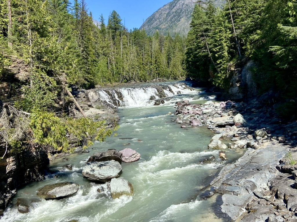
The other way to enter the GTTSR from the west was to go in after 3 p.m. So, after our afternoon at the beach, we rode the Tiger to McDonald Falls. It wasn't as good as Sacred Dancing Falls but was still spectacular with aggressive flow.
We decided to play the “National Park Game” again that night for another GTTSR reservation the next day. We rode the Tiger to Freda’s bar in West Glacier Village since it had WIFI. We got a beer and sat outside to call Tyler. I had huckleberry lemonade beer. Huckleberries were in everything there. We called Tyler and I looked up to see Mark's Uncle Mike Dye, whom we knew was in the area vacationing too. I said, “There's your uncle” and we told Tyler we'd call him back. Mark went behind his Aunt Kathy and told her he she had his seat. She said, “You little shit!” then laughed and hugged us both hard. Mike came back from getting their dog and went to get their food. He said, “This was one for the memory books.” We sat and talked to them about an hour and a half. After they left, we got another beer, called Tyler back, then waited to try for the reservation. Mark ended up getting this one on his phone. Back at camp we had hot dogs and sat by the fire for a nice evening. It was a Memory Book Glacier Day!
 |
| Figure 21. Mark and his Uncle Mike's surprise meetup in West Glacier. |
The next morning, we took our time with another morning fire, oatmeal, and coffee then headed out about 9:00 a.m. Unfortunately, we needed gas in the bike so had to wait in line to get back into the park’s gate, then wait again to enter the GTTSR, and again for road construction. Our destination that morning was Avalanche Lake. We found an actual parking spot, instead of the usual small corner, at the entrance to the Trail of the Cedars. It was a boardwalk through giant western cedar and hemlock trees in a very magical feeling place. When the boardwalk ended, we hiked on toward Avalanche Lake, up and down, and along a raging creek, through large boulders, passed many moss covered rocks and ground. Mark was amazed. We took our time and sauntered at a nice pace to the lake. Once there, we sat by the lake on a rock to dip our feet in the cold water and have a Cliff bar. A comma butterfly seemed to like me and landed on me for a long time. It kept following me as I moved around. We walked all the way to the end of the lake. From the upper trail the lake was a gorgeous aqua blue color from the glacier flour above.
 |
| Figure 22. Avalanche Lake at Glacier National Park. |
The almost 10-mile hike ended up taking us 4 hours. By the time we got back to the bike we were tired, so we laid in the front on our parking area in the forest to rest and have a snack. Once rested, we got on the bike and rode to the Lake McDonald Lodge. It is also historic and very impressive. We had a beer outside by the lake. Then we rode to Apgar village and had huckleberry ice cream.
We got back to camp just as it started to thunder. We got the bike all covered up and were inside as it started to rain. We were warm and the van battery was low, so we started the generator and air conditioner, then made a pizza on the stove. We took showers and were ready to hunker down for the night when it started to hail. Pea sized hail covered the ground. That made for a crazy, but memorable, last day at Glacier.
Entering Washington State
Tuesday morning, we took our time getting ready and hooked up. It took longer than usual since everything was so wet and dirty. Our next destination was to see our friends Roy and Nell in Spokane, Washington. We arrived late afternoon and settled in. They recently bought a 1930 log home. It sits on about an acre of mostly Ponderosa pines. We stayed in their spare bedroom with our own bathroom. They had a gigantic dog. It's an English mastiff named Whiskey. He was very friendly. Nell served us some veggies, cheese, and dips with beer for a snack while we caught up. Then we drove to eat at a unique Tex-mex place, in an old library, called Bad Seed. They had vegan options for me, and it was all good.
Wednesday morning Roy made us eggs, toast, and coffee then we drove around and visited various places in Spokane. We went first to Manito Park to the Japanese, rose, and perennial gardens. They were very well maintained and quite colorful. We drove downtown and had beers in an Irish pub then walked around the riverfront area. Nell and I rode the merry-go-round. It was fun and went fast. It had a ring game where I'd catch a ring as I rode by then try to throw it into a hole in a sign. I made one.
 |
| Figure 23. Japanese Garden at Manito Park in Spokane, Washington. |
The river there was fast with many raging waterfalls over boulders with one larger drop. The entire area was used for an Expo World’s Fair several years ago. Nell remembered going there as a kid. We drove to Coeur d'Alene in Idaho just over the border, stopping first for a late lunch at a fast noodle place. I was hungry and it was good. We walked all around the pier and a little inside the resort. Back at the house they served beers outside, then made supper on the grill of roasted brussels sprouts, grilled steelhead, and salad. What a great evening!
The next morning, we had coffee then hit the road. We stopped in Davenport, Washington to do some laundry and grocery shopping, then drove on to stay at Steamboat Rock State Park in the dune loop, site 322. It had a short, paved drive so we had to back the moto-trailer in and unhook it and put the van beside it. They irrigate so the grass all around us was green. There were small shade trees here and there and, though it was a hot day, we were comfortable. It is a very dry area with many fires so there was a fire ban in the whole state of Washington. We had to cook inside the camper while in Washington, which was too bad because all the campsites we stayed at had nice firepit grates. A kid near us was cleaning 10 big white fish that he had caught on shrimp out of the adjacent lake. They sure looked nice. Banks Lake was formed when they damned the Columbia River with the historic Grand Coulee Dam. We were so close to it that we later wish we would have went to see it. There were lots of families with kids there. The campground was not very private, but it was comfortable. After settling in, we went for a walk to the boat dock, beach, and concession area where we each had a rainbow push-up. A gigantic rock behind us was called steamboat rock, and it did look like a giant steamboat. We sat at our campsite a long time and read. Later, we made quesadillas for supper inside the van and ate them outside. We walked around all four loops of the dune campground area where we saw campers and tents of every size and configuration.
 |
| Figure 24. Steamboat Rock State Park in Washington. |
North Cascade National Park
Friday morning, we had breakfast then hooked up the trailer and left. The GPS had us take the long way around to North Cascades National Park due to a road closure on Route 20 through the park. It took several hours longer, but that was okay. It rained most of the way and the traffic was heavy until we turned off onto a mountain road to avoid an accident on the Interstate.
We arrived at North Cascade National Park’s Newhalem campground’s site 71C in the late afternoon. I put on my raincoat and guided mark into the short site. It said it was 53 foot, but the first part was a steep curve. We unloaded the bike and pushed the trailer sideways at the end of the site, then pushed the bike next to it. Mark pulled the camper in forward to face the picnic area. We had a coffee and tea to dry and warm up then drove the van to the visitor center to get maps and information before they closed at 5:00 p.m.
Back at camp we never left the van. We made calzones in a cast iron pan on the stove. They turned out good. At 7:00 p.m. we put in a movie, but I slept through most of it. It rained most of the night, all morning, and through most of the next day.
The next day started with an hour and a half at the visitor center exploring all the displays. We went on a short hike behind the visitor center on the Sterling Munro Boardwalk to a view, though it was too foggy to see the view. Giant western red cedar and hemlock surrounded us, covered in mosses. We were in the rainforest in the rain. We got cold so had coffee and tea in the van before driving back to our campsite. We surprisingly had phone service there, so Mark watched motocross while I wrote, sorted photos, studied plants, and read.
In midafternoon, we drove the van along the North Cascades Highway. Apparently, Route 20 was closed from a landslide, but reopened the day before, even though our GPS took us all the way around. It was still lightly raining during our afternoon drive. Just past our Newhalem campground and the visitor center was the Newhalem town. It was mostly for the electric company that manages the three dams there that power Seattle. However, due to all the fires it was also a temporary fire camp. Mark thought I said campfire and thought that Campfire Girls were retreating there. “No.” I said, “It's a camp for the firefighters.” There were food carts, tents, porta potties, and a small encampment there for the folks fighting nearby forest fires and clearing the mud slides from the road. Several times along the highway we saw firefighters, but mostly we saw big canvas boxes filled with water pumped from the creeks below. Those firefighters are our country's heroes as they save our natural resources and parks. Black charred, tall pencil-like remnants of recently burned evergreen trees stood in recent burn areas. Smoldering smoke, or fog, slowly seeped across them. It was eerie, yet the moisture in the air seemed to be a sign that new life was gurgling at the soil surface, ready to start again.
As we did our evening drive, we stopped a couple times to hike or view the area. At Gorge Creek Falls we walked a short loop and saw a small waterfall. Around the next corner Gorge Lake appeared, shining in its arctic blue color. It's the first of the three dammed lakes there. The second dam forms Lake Diablo. The scenic overlook there was windy and cold, so we didn't stay long. It's the most popular view in the park. Kayakers were way below us on the lake and we wondered if they were warmer than us, up high in the wind. The third dam forms Lake Ross. We didn't see it but there were lots of cars at that overlook.
 |
| Figure 25. Lake Diablo at North Cascades National Park. |
A long way past that, officially out of the National Park and into National Forests, we pulled into Rainy Pass. At 4,800-feet the trees were different there with more columnar shaped firs. On the way back towards camp we stopped to hike the short Happy Creek Nature Trail. Mostly a boardwalk, it was filled with giant fire scarred Douglas fir trees. Underneath them the western cedars and hemlocks were making a comeback from long ago fires. A short trail at the end of the waterfall was closed for fire activity, but the creek there still flowed quickly. It was such an honor to walk among those ancient giants.
 |
| Figure 26. Happy Creek Nature Trail at North Cascade National Park. |
After supper the rain let up, so we went for a walk. Wow, what a place! We entered a narrow path and were immediately engulfed in the Pacific northwest temperate rainforest. Mosses and ferns grew everywhere on the rocks, trees, fallen logs, and more. I felt like I was in an Avatar movie and dancing neon flowers would open at any moment. But of course, that didn't happen. Yet, I did stand and look around for a long time. The neon green hairy mosses were striking in the evening light. All around and above us were Douglas fir, western hemlock and cedar trees, with smaller alders growing along the water. Salal and pink huckleberry grew underneath.
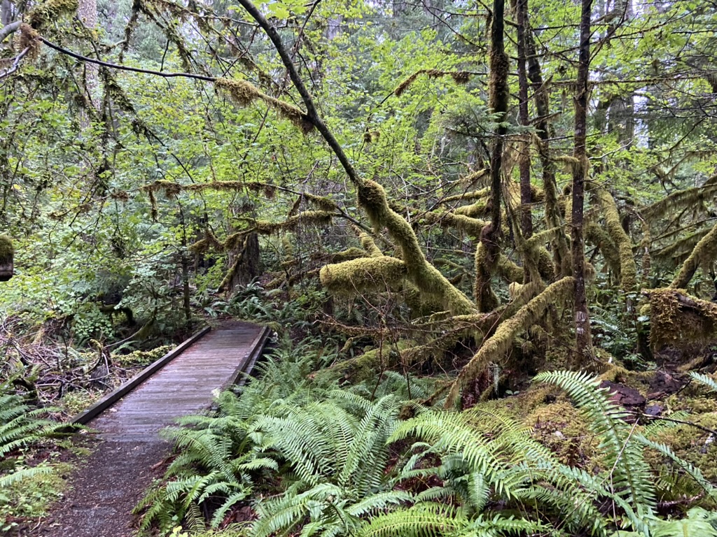 |
| Figure 27. Trail at North Cascade National Park. |
We loved it so much there that the next morning we took our camp chairs and had coffee by the Skagit river across from our campground. As it was the previous night, the area was blanketed in a light cloud layer that mostly masked the mountains around us. I could see evergreen treetops of the higher plants here and there through the fog. Or was it smoke? There were a lot of wildfires there.
As I finished my morning coffee sitting along the Skagit river, I heard the roar of the river as it rushed and poured and boiled past me. White frothy caps highlighted the deep green blue water as it flowed across the rocky boulders beneath. Mark was sitting behind me at the mouth of where the smaller Newhalem Creek flowed into the river. It was a peaceful way to spend a Sunday morning. A man was fly fishing next to me and I felt the bliss of the forest around me. Some of it was charred, but mostly it was alive and singing joyful music.
 |
| Figure 28. Mark by Skagit River in North Cascade National Park. |
After morning coffee at the river, we walked the trails around Newhalem campground while we waited for it to warm up and the fog to dissipate. We hiked a Learn a Tree Trail that had many signs about the trees. I read every one and finally started we see some differences in the evergreens. Some trees there were quite giant. We hiked the River Trail that went through a former forest fire area. Many of the giant Douglas firs there, survived. However, a large one stood tall like a stripped, black ink pen reaching for the sky. The heat that fire had must have been extraordinary.
 |
| Figure 29. Rhonda between ancient giants in North Cascade National Park. Left-Western Cedar. Right-Douglas Fir. |
Back at camp, we geared up and rode the Tiger all the way to Washington Pass. Wow what a view! We could see several glaciers there and the trees and other plants were amazing. North Cascades National Park has over 300 active glaciers, many more than Glacier National Park. I took video of the ride there and many places along the way.
 |
| Figure 30. Mark at Washington Pass in North Cascade National Park. |
After stopping at Washington Pass, we rode to Rainy Pass to hike what we thought was a short, handicapped accessible trail to Rainy Lake. It was a paved path, but still was a mile there and another mile back. It was cool there at the higher elevations, so we left on all our riding gear, thinking it was a short hike. What a mistake. Those extra layers and weight from the armor completely wore us out. Still, the hike there was interesting. We saw some new plants. Many were described in signs, though many I needed to key out later. Rainy Lake was small. A glacier above it had at least two tall waterfalls flowing into the lake. The lake seemed to be in a large rocky bowl called a glacier cirque. Shadows on the lake made it hard to tell where the lake and mountains split to form the perfect mirror images. After hiking, we rested at a picnic table before riding the long road back to camp. We pulled over a couple times to view the scenery but didn't get off the bike. Back at camp we finally were able to sit outside on dry lawn chairs with a beverage.
 |
| Figure 31. Rainey Lake at North Cascade National Park. |
We decided to go ahead and load the trailer and Tiger since we knew we had a long drive the next day. We were glad we did. Mark said it'd take 15 minutes, but it took more like 45 minutes. The driveway angle was odd, so I ended up pulling the trailer all around the campground while Mark waited to load the Tiger. Once loaded, we were able to back it all the way in, staying on level enough ground for one night. It worked out perfectly. We moved our chairs and tables to the tent area since our van was now facing the wrong direction from the picnic area. We were surprised how many of the sites we'd seen were backwards for campers. I guess they were originally designed for tents.
Olympic National Park
On Monday morning we drove the long way around to Olympic National Park, avoiding the shorter and confusing ferry crossings. After a short stop at the Visitor Center in Port Angeles, we arrived at a rainy and wet Mora campground around 5:30 p.m. It was a long travel day. Site 55c was mostly a drive-in spot with an elbow, so we pulled in and didn't unhook. We just stayed warm and dry in the van. We opened the door to see the rain forest and giant trees all around us, then made an amazing supper of burgers, potatoes, and beans. We fired up the generator for about 10 minutes to cook the potatoes.
 |
| Figure 32. Mora Campground at Olympic National Park. |
The next morning, Mark unhooked the trailer, and we drove the van about a mile to Rialto beach. We made coffee in the van and sat in our chairs by the ocean. It was a unique beach. Behind us all along the coast were gigantic logs that obviously drifted there at some point. As I looked over the ocean, the sun started to rise above the trees behind me, illuminating the milky white waves it touched. The waves without sunlight were light gray next to the brilliant white sunlit ones. Waves rolled rapidly with small curls. There were rocks everywhere. White caps hit boulders out farther before rushing into shore. A line of tan, white foam lined the beach about 5 feet from the surface edge. It was a large amount of foam about a foot tall and at times 2 feet wide. To my left were large rock islands. To my right about a mile down the beach was the famous Hole-In-the-Rock formation. Hikers were heading there although it was almost high tide, so would be hard to do until low tide just after lunch. To me this was a black sand beach. Black sand was behind the log jams. I sat in my chair on larger, smooth, black and gray rocks. They varied in size from one to six inches in all shapes. Occasionally a white or speckled one stood out among the black mass. I had never seen a beach of rocks like that. It was interesting, mesmerizing, and beautiful.
It was a gorgeous day. The sky was blue, the ocean was dark blue with white waves, the beach was black, and I watched Mark as he walked along the shore. He loves the water. I felt nature's power there. It was like a strong back and a gentle heart sending me vibes of contentment bliss. It took getting all the way to the ocean for me to feel a moment of bliss. I had arrived.
 |
| Figure 33. Mark at Rialto Beach in Olympic National Park. |
We regrouped at camp and drove the van to the Sol Duc area. At the gate the ranger gave us a map with trails and info for the area. We stopped first at the Salmon Cascades and walked to the Sol Duc River. A couple was sitting closer to the river and later said she sat an hour and saw one salmon swim up and over the cascade. Two types of salmon were running that time of year. We didn't see any salmon, yet it was fascinating to see the cascades and imagine them jumping across.
 |
| Figure 34. Salmon Cascades in Sol Duc area of Olympic National Park. |
From there we drove to the end on the area to hike to Sol Duc Falls. It was about a two-mile saunter through old growth forest to a three-cascade waterfall. Below the giant Douglas fir, Sitka spruce, and western cedar trees was a diversity of understory plants. We walked along many deep caverns and cliffs. One rock wall across from us was covered in ferns of several types. Mark pointed out the five fingered maidenhair ferns. Lots of salal and huckleberry, and many big devil's club plants with bright red berries. The water raged down the mountain to the rocky cut outs of the waterfall. It made three cascades over the years and there seemed to be a fourth one forming as a trickle. On the other side of a bridge the water came together and cut a narrow gorge down the hill out of stone. Mark really liked that trail.
 |
| Figure 35. Sol Duc Falls in Olympic National Park. |
I really enjoyed it though liked the Ancient Groves Trail even better. It was a short loop through old growth forest. There weren't as many understory plants, and it was much flatter and mossier. Yet the trees there were so massive. We were mostly alone, and the gentle giants guided us through their magical kingdom. In the middle was of river of ferns that got wetter and wetter and revealed a sea of skunk cabbage. Their big leaves were such a contrast from the delicate ferns. At the entrance an informational sign stated that some of the trees were there before Columbus sailed here over 500 years ago. Amazing! We saw some interesting fungi in there too. A big lichen on the ground looked like reindeer lichen. Mushrooms emerged in all sizes. As we looked closely at the mossy forest floor, miniature toadstools formed little towns for tiny fairies. It was that magical feeling.
 |
| Figure 36. Ferns and skunk cabbage along the Ancient Groves Trail in the Sol Duc area of Olympic National Park. |
From there we drove to Crescent Lake and had lunch in the La Poel picnic area of yogurt and granola bars and made hot tea and coffee in the van. After lunch we continued our amazing botanical journey seeing new plants and colors around every corner. I kept seeing pink flowers at a glance and thought they were foxglove, then I'd see fireweed and decide I was wrong. Later I confirmed they were foxglove when we parked by blooming plants.
Our friend Jeff Smith told us about a neat area to see on the north of the peninsula along the Strait of Juan de Fuca. They had stayed at or near Tongue Point by the Salt River. It was a long drive around Crescent Lake to the upper road along the strait. Jeff was right. It was an awesome place to see. From the Salt Creek Country Park we could see Canada across the water. We drove all the way to Clallam Bay where we stopped at Breakers Restaurant for supper. We were hoping for fresh salmon but ended up with cod fish and chips. It was a hole-in-the-wall local place with friendly people and lots of good food. We had a table by the window and could see shadows of Canada in the distance across the water. We only ate half of our meals so planned to eat the rest of it the next night. By the time we got back to camp we were tired, and it was too cold to sit outside. We didn't really sit outside the Mora campsite, but we did like it there.
 |
| Figure 37. View of Canada across the Strait of Juan de Fuca. |
The next morning, we packed up and drove to Ruby Beach for the day. It was impressive and we liked it better than Rialto. The ranger at the visitor center suggested we hang out there before moving to our next campground since the lines into the Hoh Rainforest were a one to two hour wait during the day. What a great suggestion. We lucked out and got a parking spot for oversized vehicles since we had the trailer. The tide was going out, so we walked along the beach, across a couple small streams, and climbed rocky areas to watch the ocean. As the tide waned, starfish and green anemone started to show on the edge of rocks. It was fascinating to watch. We sat out there on a big rock and watched the waves rolling in. I've seen the ocean many times and it continues to amaze and mesmerize me. This beach also had large drift logs. A sign said they washed down from the rivers during floods and spring melts. Large, jagged rocks were in the ocean along the shore. One large one has trees and plants on top of it, but most were bare except for sea life. The beach had smooth rocks there too, though they weren’t as black as those at Rialto. As we sat there in our chairs next to the giant drift logs, the ocean breeze was cool. It felt good in combination with the full sun in a bright blue sky overhead. A perfect day!
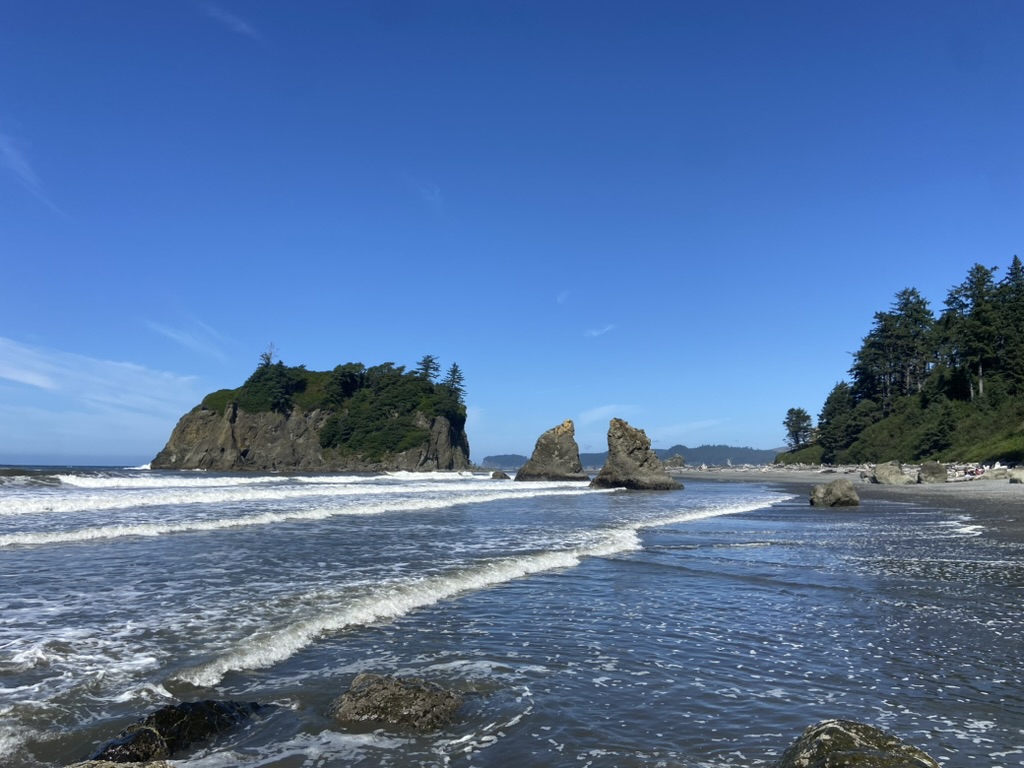 |
| Figure 38. Ruby Beach in Olympic National Park. |
We stayed at the beach until about 3:00 p.m. then headed toward our new campground. Everyone said to wait to arrive until after 5 p.m. to avoid crowds and long waits at the gate. We arrived at 4 p.m. with no wait and drove to the most awesome campsite we've ever had. Site 63C in the Hoh Rainforest Campground was large and had access to the Hoh River. It had a short gravel driveway that easily fit our van and trailer backed in. Behind us was a large Sitka spruce and a big leaf maple tree. A large grassy area and sword ferns with snowberry shrubs filled in the rest. There was so much room. Our van solar panels got full sun, yet we had shade in the picnic area. We just wished we could have had a campfire. Soon we were sitting by the river with a beverage. We walked around camp and to the visitor center to see where it was. All the trails were there too.
 |
| Figure 39. Hoh Rainforest Campground in Olympic National Park. |
The next morning, we walked back to the visitor center at 9:00 a.m. and listened to a ranger talk about the temperate rainforest. She was very informative. We were fascinated by the unique ecosystem there. It was simple, yet so complex. It had four types of evergreen trees: a few Douglas fir and western red cedar, several western hemlock, and mostly Sitka spruce. There were also four deciduous types of trees: red alder along riverbanks, bigleaf maple, vine maple, and black Cottonwood. We looked at the exhibits inside. I bought an Audubon book for the Pacific Northwest and got another passport stamp.
We hiked the Spruce Nature Trail for 1 ½ hours on a pleasant leisurely stroll through the giant trees. There were many examples of all growth stages of nurse logs where new and old trees grew. When trees fall, new trees and plants seed into the mosses on the fallen nurse log. Over the years they send roots over the edge of the log and eventually as the log decomposes, the trees appear to be on stilts.
 |
| Figure 40. Mark by mature Sitka spruce growing in a row where they seeded years ago on a downed nurse log. |
Later I sat in the rocky stream bed down from our campsite while Mark explored the area. It had big smooth rocks like those at the beaches. I heard the trickle of the babbling brook in front of me. I heard ravens call, wrens sing, and willow and alder leaves rattle. A large mountain of evergreens towered beyond. Just beyond the stream trees was a line of narrow evergreens. There was something perfumery smelling there. I get a whiff every now and then but didn’t see any blooms. I smelled it many times during our three nights there, but never did figure out its source. The lovely sensual pleasure washed calm over me. We loved the easy pace there where we walked everywhere and could take our time to really experience and soak in the essence of Olympics’ rainforest.
Mark came back from his walk to the river and said he was going back with his chair, so I joined him. He said it was a rough trek to get there. First, he walked along a big log perched four feet above the water. I, on the other hand, freaked out and decided to use a lower route. From there we mostly walked on large boulders, across small streams, and through black sand to get to the Hoh River. As Mark promised, it was impressive. It had the glacier milky, slate blue water and we were there all alone. The only signs of others were elk footprints and droppings. I kept expecting one to walk up any time. The Roosevelt elk there were unique to that peninsula and the park was formed partly to protect them. I sat there and read my book “Gathering Moss” by Robin Wall Kimmerer. It seemed appropriate reading while in a rainforest full of mosses. We were fascinated by the various rivers and streams that we saw there. At the Hoh River I kept hearing a gushing sound every now and then, like a drain opening. We think that the water built up along a downed snag tree in the river until it gushed through.
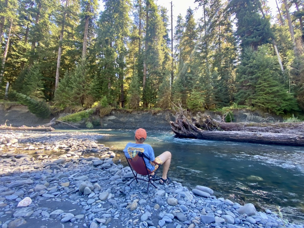 |
| Figure 41. Mark by the Hoh River. |
Later in the afternoon, we walked the Hall of Mosses Trail. It was another trail through old growth trees. This time there were large groves of old bigleaf maples completely shrouded in shaggy moss, many with ferns and huckleberry growing in the moss. The trees were spread out with limbs weighted down by the mosses and ferns. I told Mark I thought they looked tired and sad from holding that weight all these years. Yet the trees needed the symbiotic relationship of the ferns and mosses in order to thrive. That hike had many giant Douglas fir, Sitka spruce, and western hemlock trees. As we entered the trail, we noticed one Douglas fir that towered above the others. Mark said it looked like a giant broccoli cap. We stopped on a bridge and looked for coho salmon. After a bit we started to see the little 4-to-5-inch fish in the cold stream. The stream there was flowing so quick that the bright green water plants moved with it. The salmon had a perfect home there for a few years before they moved to the ocean, only to come back to reproduce and die. Salmon are amazing.
 |
| Figure 42. Bigleaf maples in the Hall of Mosses Trail at Olympic National Park. |
We saw many forms of wildlife there. As we entered the Hall of Mosses Trail a tiny rabbit crossed my path and fed on a trail side plant. The small rabbit had black on its big ears and was quite cute. Gray jays seemed to follow us as we hiked in various locations. Tiny wrens sang and ravens flew into a tree near us, then flew off in a ruckus. A black tail deer doe with twins walked through camp one morning. nibbling on grass or something along the road. The fawns still had faint spots.
On Friday we hiked 10 miles on the Hoh River Trail. The trail was through the forests and loosely followed the river. Sword ferns and salmonberry lined most of the trail. Our first destination was Mineral Spring Creeks Falls. We stood on a little bridge and at first it looked like a small cascade. Then Mark looked up and saw the massive waterfall in the distance. It was hard to see but masses of water fell over the cliff into Mineral Springs.
Hiking through old growth rainforest is amazing. We saw bunchberry in bloom and fruit. I finally found some salmonberry fruits. A pair of scrub jays followed us a bit and screamed as they flew away and shoot dry leaves from a bigleaf maple. It looked like autumn. Our goal was to hike 4 miles to the giant cedar grove, so we did that and a little more. We saw four to six giant cedars there and noted the seed debris beneath the largest cedar. The squirrels which were small and black must have liked the cedar cones. At the cedars area we stopped for a lunch break before returning, however that was short lived due to the many mosquitoes. The vanilla spray I had with me didn't work very well. We needed to rest longer but pushed on away from the biting beasts. Still, it was a great saunter through the primeval Hoh Rainforest where time had no meaning.
 |
| Figure 43. Hoh River Trail at Olympic National Park. |
Home Through Yellowstone and the Badlands
Saturday, we packed up and drove across the state of Washington 11 hours to the Wolf Lodge RV site in Coeur d'Alene, Idaho. We had a pull through site with electric and water. It was a good place to stop for supper and sleep.
From there we drove eight hour to Red Lodge, Montana’s Perrys RV Park. It was not a great campsite, but very little was open for Labor Day. It was a pull through gravel site with electric and water but no fire pit or table. After we arrived, we drove through town to the Red Lodge Ale Brewery for supper. We sat outside and watched as the smoke-filled skies to the west partially blocked the setting sun, creating a pretty picture. The beer and food were good too.
Riding Beartooth Highway was on our bucket list, so we decided to do that on our way home. We had visited Yellowstone a few years earlier and didn’t know about that road. When we found out about it, it quickly moved to the top of our bucket list. The highway runs between Red Lodge and Cooke City, Montana and flows directly into Yellowstone National Park.
Tuesday was a “Wow” day! We started out riding the amazing Beartooth Highway. As written, it is likely one of the most beautiful motorcycle roads in America. It winds up and around switchbacks and curves to the very top, above the tree line in the tundra. I love that. It was quite cold up there and we were prepared with our gear. We stopped at a vista point rest area to see the views. A short walk there to a point gave us a 180° view of the mountains and displays explained how glaciers formed the valley. I videotaped us riding through the valleys and over the tundra. We rode past the summit of Bear Tooth Pass at 10,947-feet and kept going. We did pull over a couple times but stayed on the bike.
 |
| Figure 44. Riding Beartooth Highway. |
When we got to Yellowstone’s northeast entrance it was about noon, so we went in. We found a picnic spot to eat lunch and rested at the first pull off. We decided it was early, and since the last time we visited Yellowstone one of the roads was closed, we decided to ride Tower Roosevelt Road to Canyon Village and see the Grand Canyon of the Yellowstone again with less smoke. It was a good plan except we had forgotten, or misgauged, how far it was and how crowded it was there on Labor Day. The ride across the Lamar valley started great. We could see huge herds of bison out in the distance. It was quite a site to see them in their natural landscape. However, as we got closer to Tower Roosevelt Road there was a herd close to the road and cars stopped to take pictures, putting us in a vulnerable situation. That went okay and we avoided close exposure to the giant beasts.
 |
| Figure 45. Bison in Yellowstone National Park's Lamar Valley. |
We rode to Canyon Village and through the North Rim Road twice. We had to wait or skip past several cars waiting on parking spaces. The first time we missed the Inspiration Point turn off because we were looking for the Artist Point, so we rode through it again, deciding it was at Inspiration Point. It was not. It was on the South Rim Drive. We got off the bike at Inspiration Point and took a long break to regroup. By then it was 2:30 p.m. and we had at least a three-hour ride back to Red Lodge.
So, we headed back. It was scary on the motorcycle ride through the Lamar valley. This time lots of vehicles were stopped and many sections had bison on the road. Mark rode around a couple stopped cars. One bison started to cross in front of us, but Mark was able to ride on when it went the other way. I just wanted away from them. Crazy animals and tourists.
That was stressful, then it started to rain. Luckily it didn't pour hard, and we dried quickly. Still, I was tired and sore by the time we got to Cooke City, so we stopped at a local bar for a beer break. We needed that. There was no cell service so couldn't check on the weather to see if it was safe to ride the Beartooth Highway back to camp yet, so we went for it. Mark did an amazing job navigating the road. We rode into camp about 6:00 p.m. It was a beautiful ride. The scenery along the highway is too amazing to describe. It’s views of trees, mountains, lakes, snow, cliffs, valleys, and alpine plants go on and on forever.
 |
| Figure 46. Entering the rainbow on Beartooth Highway after visiting Yellowstone National Park. |
By the time we got back to camp, we were exhausted. I sort of slid off the bike and laid in the camper while Mark fixed quesadillas for supper. Then he hit a wall, and we were done for the night. The next morning, Mark was revived and rode up to Beartooth Pass again alone. He wanted to get a picture there and to see the Beartooth Peak better. It was drizzling when he left, but sunny later.
We stayed on night at Wind Cave National Parks Elk Mountain Campground. It was mostly empty, so we drove around and decided on site 16. The self-check-in process was easy and soon we relaxed by a campfire. It was so nice to finally sit outside by a campfire again. There were huge, burned areas across most of Wyoming on I-90 so I understood the fire bans. It was pretty dry in South Dakota too, but fires were allowed in campground firepits. As we roasted our supper on the fire, we watched the Wind Cave bison herd come over a hill. Lots of rabbits were there too. It was mostly open, rolling prairie, but there were pine trees on the hills beside us.
Thursday September 5th, we visited two more national parks before traveling on to Iowa. We started at the Wind Cave Visitor Center. Cave tours were cancelled for summer upgrades, so we just explored the center. Upstairs it covered the upper parts of the park where bison herds with original bison DNA roam, and prairie dogs and black footed ferret thrive. We saw more bison as we drove out, coasting along with them on both sides of the road with a motorcycle rider behind us. We all kept going like we are supposed to.
 |
| Figure 47. Driving through bison at Wind Cave National Park. |
We also stopped at Badlands National Park on our way, making it our seventh national park of the trip. We rode through there several years ago on Harleys when we rode to Sturgis, but we didn't go to the visitor center. This time we went there, and I got my passport stamp. Along the drive, we took a few pictures and noted the differences of the landscape from others with similarities like Teddy Roosevelt and the Petrified Forest’s Painted Desert.
 |
| Figure 48. Badlands National Park. |
The rest of the day was uneventful driving. I drove the last couple of hours. Our destination was Stone State Park in Sioux City, Iowa. However, when we got there it seemed sketchy and Mark was uneasy staying. There were vagrant-like vehicles there and it appeared unkempt. So, we looked up a second choice which was a nearby KOA. It was great. The after-hours no reservation system was easy and soon we were parked and enjoying a beverage by our camper. On that last night we used the portable grill we had bought for the trip. Fire bans prevented us from using it most places. We grilled burgers and had beans.
The next day we arrived home after another eight-hour drive day. I drove the last couple hours again. We stopped at Casey’s in Havana on our way home for a pizza. As usual, our home and yard looked great when we arrived thanks to timed irrigation and family who helped while we were gone. It was a bittersweet feeling to end our amazing trip, yet we love our home too. After a long rest we’ll be ready to play the “National Park Game” again.