Wednesday, August 27, 2025

Exploring Colorado’s Mountain Magic

We’ve been to Colorado many times and each year yearn to go back to the mountains where we explore new locations and find nature’s magic among the clouds. This year Mark signed up to do the Colorado Gold Rush Motorcycle Ride. His goal was to ride the mountain passes that were blocked by snow during his 2023 Trans America Trail trip (see our book Two View of the TAT on Amazon). I decided to tag along and do some hiking and bicycling while he rode his motorcycle. In the end, the trip didn’t go as planned, but we still found mountain magic and had a grand adventure. 

Our long trip from Illinois to Colorado started on Thursday, August 7, 2025, in very hot weather. We stayed several nights along the way before reaching our destination of Ouray, Colorado. The first night was at Sand Hills State Park near Hutchinson, Kansas. Friday night we stayed at a KOA campground in Canon City, Colorado where we were able to refill our RV propane tank.

Figure 1. KOA campground in Canon City, Colorado.

Saturday night we reserved a spot at a Harvest Host location called the LaNoue DuBois Winery, which was south of Montrose. The winery owner directed us to a big field next to his vineyard about a half mile from the tasting room. At first it looked good. We parked along the river and put out the awning. I did my daily meditation. Mark tried to walk to the river, but it was too steep with too many trees. I was worried when a small breeze picked up and had just stepped inside to bring in the awning, when it turned into a gusty, dust storm. I grabbed one arm of the awning as the awning’s wind generated auto retract started to work, but it goes in too slowly. I kept saying “No, no, no,” while Mark grabbed the other arm of the awning. In the end it went in without breaking, but dust was everywhere in the camper. We decided not to stay in that spot. Instead, we went to town for supper because the winery didn't have food and it was too hot to cook inside the van. Back at the winery we parked by the building instead and enjoyed a bottle of wine on their patio. 

Sunday morning, we decided to spend some time at Ridgway State Park on the way to our Ouray campground since we couldn't check in until 1:00 p.m. We went to the park’s visitor center and realized that this area was where the John Wayne movie True Grit was filmed. We hiked a few trails and checked out one of the campgrounds, which was very nice. 

Figure 2. View of Ridgway State Park's reservoir from a hiking trail.

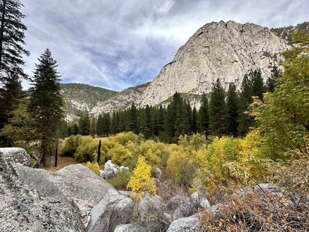
When we got to Ouray, we stopped at the town’s visitor center, and a nice lady gave me good ideas of things to do while Mark rode his motorcycle each day. I’d already done the Via Ferrata there, but this time I had my bicycle and there was also a hiking trail that went all around the town. We walked into town and met Mark's friend for lunch, then drove to our J4+1+1 campground where we stayed the next three nights. At first, I was very disappointed. Our site (#16) was in the middle of an asphalt and gravel area between many other campers with no view of the river. Yet, it was a very good spot for Mark to meet his fellow Gold Rush riders each day and that was why we were there. Each day, I grew to like it more. We were tucked into the edge of Ouray, nicknamed the "Switzerland of America" due to its similarity to the Swiss Alps. We were next to towering cliffs that surrounded the town. The evergreens and plants on the cliffs were quite pretty, and we had a good view of the mountains in the distance.

Figure 3. Ouray, Colorado view.

Mark had been planning the Colorado Gold Rush Ride for months, and he was so excited for it to begin. After we arrived, we went to the rider’s welcome meeting, though it wasn't much of a meeting. We did meet the lead guy that Mark had been emailing. Riders came from as far as Mexico City to do the ride each year. It was free but had fundraisers included to raise funds for the trail maintenance organizations. After the meeting three of us went to the St. Elmo Hotel bar and had some drinks. Later we had dinner in the Ouray Brewery. I had a good Billy goat burger that had an impossible burger with goat cheese. 

Figure 4. Mark leaves for his first riding day in Ouray, Colorado.

Monday August 11 was Mark's first riding day. He rode with his friend and two other guys. After Mark left, I did yoga then loaded my bicycle into the van and drove back to Ridgway State Park to spend the day. I started at a trail across from the park’s entrance, but once I was on the trail I didn’t like its isolation and openness. I had already paid the park fee at that gate, so I drove to the visitor center and asked the ranger for suggestions. His idea to spend the day at the Dallas Creek day use area was perfect. First, I hiked the Dallas Creek trail. The ranger gave me an interpretive brochure so I could follow the signs there, which I loved. It was a perfect 1.1-mile hike with a little elevation change. I identified many plants along the way. I also saw a small red snake on a narrow path between willows along the creek, though it quickly moved away into the willows and I walked on.

Figure 5. Dallas Creek Nature Trail stop #20 was a 300-foot boardwalk of composite materials through natural springs and a variety of plants.

After the hike I had lunch in the van and unloaded my bicycle. This was my first real ride on my new electronic bicycle, and I was ready. I rode along the Marmot run bicycle path to the other end of the day use area. The ranger said this paved path was one of the most scenic in Colorado with perfect views of the San Juan mountains. He was right! I loved riding my new Aventon eBike. It gave me just enough workout and allowed me to go farther and thus see more than I could hiking. I rode out to the park’s reservoir and watched kayakers and fly-fishing fishermen. One fisherman scared me as he climbed out of the willows by Dallas Creek. I thought he was a bear.

Figure 6. Marmot Run bicycle path between Ridgway State Park and Ridgway, Colorado.

I rode my bicycle back to where the van was parked and continued outside of the park to the Dennis Weaver Memorial Park. There I sat by the river under a juniper tree. The Uncompahgre river was narrow and shallow, rock lined, and very swift. It was a very pretty spot with grass and other vegetation all around me. I sat where I could see and hear the river well. The connection with nature there was just what I needed to finally relax into the trip. 

Figure 7. Dennis Weaver Memorial Park near Ridgway.

Mark rode into camp after his first day riding the mountain passes and said, “Best ride ever.” He knows I love it when he says that. He had a blast riding the mountain passes. He was a little concerned because his bike was cutting out at the end, so he took the seat off and checked connections then plugged in the battery trickle charger. The next morning it all seemed fine – for a while.

Figure 8. Mark at Engineer Pass.

Figure 9. Mark's views from the mountain tops.

Tuesday morning Mark left for his ride, and I did yoga. I had planned to do some writing and then maybe bicycle around town before my scheduled afternoon fly-fishing lesson. Instead, Mark called me mid-morning and said that his motorcycle was not working. His friend hauled it back to camp with his jeep and Mark decided to take the motorcycle to a Montrose KTM dealer for diagnosis, hoping he could continue the Gold Rush Ride. 

On his way to Montrose, Mark dropped me off in Ridgway to do my fly-fishing trip. Tony, my guide, met me at RIGS Fly Shop & Guide Service in Ridgway. He had me put on rubber socks and wading boots that were ankle high, then we drove in his Bronco to the Dennis Weaver Memorial Park. Mark and I had just been there wasting time before my 1:15 p.m. appointment. Tony and I hiked downstream a ways, which included some uphill hiking. The altitude made me winded, but I did fine. At the river Tony showed me how to use the fly-fishing rod and reel. It was quite different from others I've used. The technique was more like cane pole fishing to me. As I was trying to figure out how to cast, a fish got on. I brought it right into the net. Tony had me hold it for a picture. That's the only fish I caught, though I had a few others hit my rig. I think it was too hot for trout to be very active. My rig had an indicator (bobber) on a nylon line with two small lures below it: a fly and a leech. The nylon line was tied to a bigger line that floated and wound around the reel. 

Figure 10. Rhonda caught a trout during her fly-fishing lesson.

We walked in and out of the water, back upstream, and fished in several holes. Tony said I did very well and was a natural. He didn't have to tell me much. I think I was easier than most of his other clients. About 4:00 p.m. I started to get tired of standing and lugging my backpack that I didn't really need. We hiked to the Bronco and drove back to the store at 5:00 p.m. where Mark met us. It was funny because Mark had spent his afternoon at the same park as he waited for me, not knowing I was there.

Figure 11. Rhonda fly-fishing the Uncompahgre River.

After Mark picked me up, we had a beer and tacos in Ridgway. On the way back to Ouray we stopped at the Orvis Hot Springs. I had been there during my Silverton Yoga Retreat in 2022, but Mark hadn't. It is such a nice place and the natural springs felt so relaxing.

On Wednesday we checked out of our campground, then drove back to Ridgway where Mark rented an eBike at a shop. We rode bicycles from Ridgway up to the State Park and back again. It was the same route that I did on Monday, though we went farther and it was fun having Mark there too. We rode 10 miles for a couple of hours, stopping for snacks and to enjoy scenery along the way. 

Figure 12. Mark bicycling the path near Ridgway, Colorado.

When we returned the bicycle in Ridgway, I noticed more locations where they filmed the movie True Grit. From there we drove to Montrose to get Mark's motorcycle. They had worked on it a couple of hours but couldn't fix it, so we cancelled our campsite at Crested Butte and Mark’s Colorado Gold Rush Ride was over. It was a disappointment, but we didn’t take long to formulate a new plan, and soon were driving the Million Dollar Highway south to Silverton. 

Figure 13. Million Dollar Highway.

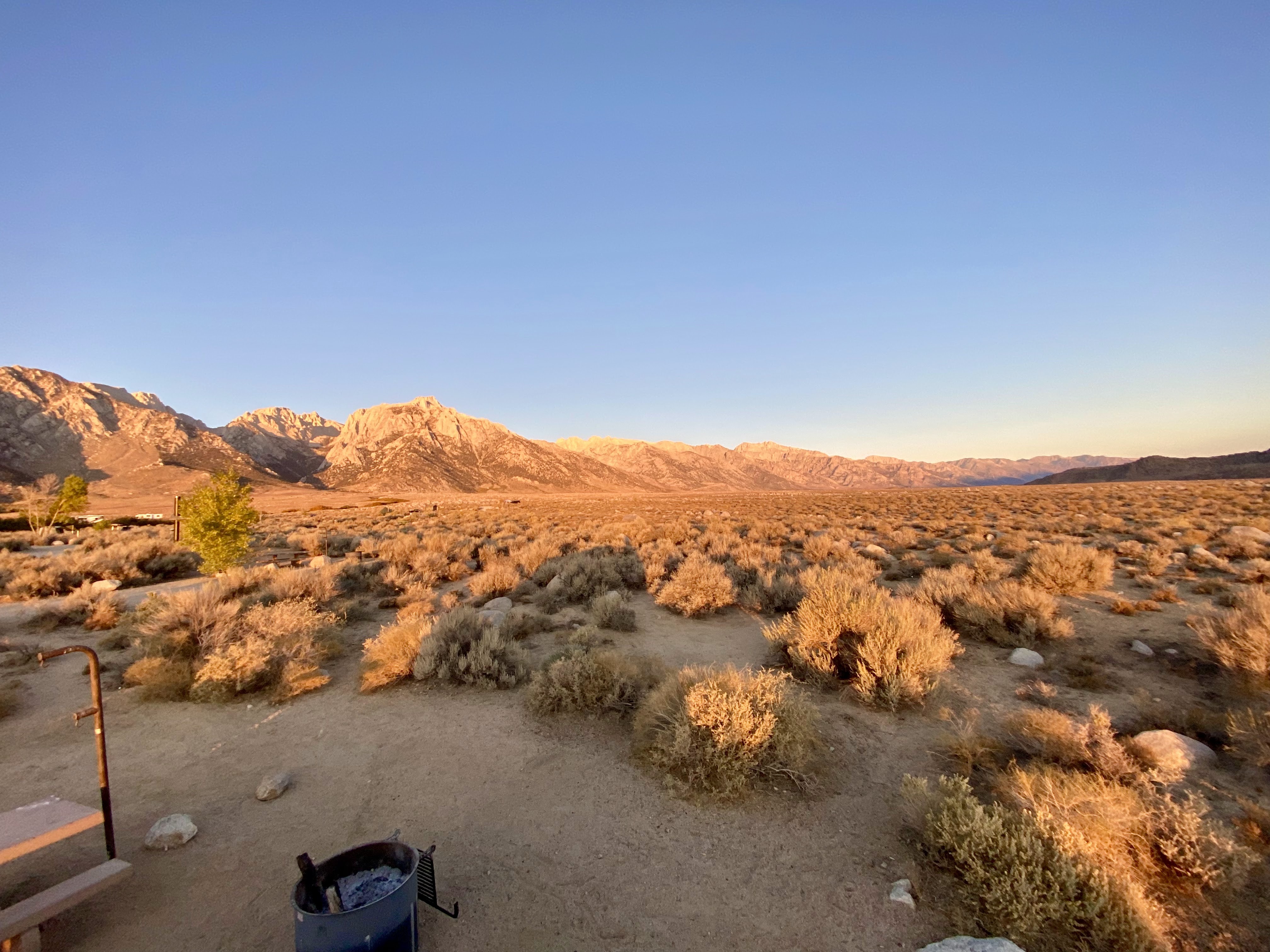
Since visiting the area in 2022, we’d been wanting to camp at South Mineral Campground near the Ice Lakes Basin. It’s a very busy national forest campground and we knew it would be hard to get one of the first come, first served sites. We lucked out and got the last one available, site #4. We arrived about 3:00 p.m. and after settling in we did a short walk along the creek. There was a fire ban so instead of a campfire we cooked burgers and beans on our camp stove outside. From our campsite we could see the mountains all around us and especially loved the upper green meadows areas. It’s our favorite type of camping with large sites surrounded by nature. We saw many different birds, squirrels, and chipmunks. Deer came into camp each evening. The air there was very thin at 9,863-feet but we quickly adjusted. 

Figure 14. Our campsite at South Mineral Campground near Silverton, Colorado.

On Friday morning, Mark made pancakes on the camp stove and then we hiked up to the alpine lakes. The trailhead was near our campground. Mark says that it is the hardest thing he has ever done. Wow! That hike was brutal. As Neil Peart from RUSH says, “Adventures suck while you're having them” and that was certainly the case that day. We started up the trail at 9:09 a.m. I carried everything in my backpack, including two liters of water for two people. It was all uphill to the lakes. The trail was 8 miles round trip with a 2,600-foot elevation gain to over 12,500 feet. The altitude and steep climb made for a very difficult, yet rewarding, hike. 
Figure 15. Rhonda at the Ice Lake Basin trial intersection.

We hiked up through a burned-out section, past a waterfall, a short meadow, an evergreen area, and another small meadow, before reaching a “T”  in the trail. A young man was coming down and said we should do the trail to the right to the Island Lake first since it's a more gradual climb. It was still a steep climb, but less gravely and steep than going clockwise to Ice Lake first. I said that I trusted him, and we went that way, however I questioned his logic many times during that last mile. We had to take more and more breaks as we neared the top. We went slow from the beginning but as we reached 11,000-feet the trail got steeper, and we slowed down even more. We would take about 10 steps and stop for five deep breaths. So, on we went, up 10 steps, stop for 5 breaths, up 10 steps, and so on. At one point I told Mark I couldn't make it because I was a bit lightheaded and it was hard to walk. But then we got inspiration from a few hikers coming down. In the end, we persevered and made it to the top.

Figure 16. Mark resting along the trail up to Island Lake.

On the way up we kept shedding layers. At the top we put them all back on. It was cold, cloudy, and windy up there. I had hiked to Ice Lake during my Silverton Yoga Retreat but had never seen Island Lake. Island Lake is a most intense royal blue color. We sat by it and had an apple and drank some more water that we’d been sipping all the way up. 

Figure 17. Rhonda at Island Lake.

From there, we decided to hike on around to Ice Lake, but just as we rounded Island Lake it got windier and colder and started to rain. My hands were so cold. I had my head down to keep my hat on and went briefly down the wrong trail. Mark quickly corrected the path, but we hadn't gone far when we needed cover. Mark said, “I need my poncho”. We hunkered beside a rock and put on the little rain ponchos I'd brought. They immediately warmed us up. Luckily, it wasn't long until the rain stopped, and we ventured on. I cinched the poncho up with my backpack straps and Tilley hat.  I looked crazy, but I was warm. That section between the two lakes was quite treacherous. One section was steep, and you had to scramble on all fours. I put both trekking poles on one wrist and crawled my way across. It wasn't that bad, but you had to be careful.

Figure 18. Mark hiking between Island Lake and Ice Lake.

As we arrived at Ice Lake it got even windier and colder. We took a long look at the ice-cold blue lake nestled into the granite bluffs with wildflowers of every color all around. Water flowed into the lake on the far side and out on the side we stood on. From there it flowed downhill over smoky colored rocks. We wanted to stay but it was too cold and already 2:00 p.m. Most people hike earlier in the morning to avoid the daily cold rain shower that often happens in the alpine lakes. It took us four hours to reach Island Lake and another hour to get to Ice Lake.

As soon as we headed back down from Ice Lake it started to get warmer and easier to breathe. I quickly took off the poncho and more layers. The rocky trail sloped down for the first half mile or so and was difficult to navigate, but not as bad as going up. We stopped partway down that section to sit on a rock and eat a snack. The rest of the way down was hard on the knees but still easier than going up. We got back to our campsite about 5:00 p.m., just as our water ran out. It had taken us eight hours to do the eight-mile hike.

Figure 19. Rhonda climbing down from Ice Lake.

Our camper felt hot, we hurt, and we were exhausted so we just laid on our beds in front of fans with the generator running the air conditioner. This site didn’t have electricity. My middle back hurt the most, probably from carrying the backpack. My right sciatica hurt too, but mostly we felt good. I was so proud of Mark and myself for completing such a difficult hike. We are so glad we did it!

After resting a bit, I took a shower and then I went and paid for two more nights at that campground. We knew that we would have trouble finding a place on the weekend and loved this campground. I made quesadillas for supper, using up the fresh avocado and tomatoes and limes that I had brought. After supper, we continued sitting outside for a bit, but we were exhausted so soon went inside. We streamed a movie with the Starlink satellite using the van’s inverter to power it. I also charged our fan batteries. 

We left the inverter on when we went to bed. At 2:00 a.m. I heard a beeping noise warning that the inverter had low battery power to operate, so I turned it off. It took us a long time to get back to sleep after that, then another beeping woke me up at 6:00 a.m. This time the solar power and RV batteries were at critical low levels, too low to even start the generator. Mark started the van for a little power and heat, but when the stove didn't work for coffee, we decided to go to town. In Silverton we went to an RV park and asked if we could pay for a spot to plug our RV into a power supply for a few hours. They were very nice and sold us a spot for $40. We plugged in and it immediately started charging. We had to reboot some of the screens but everything else worked fine. Later our campground host told us of a way to jump start the generator without having to plug it in. We are always learning more about this rig.

While the van charged, we walked around Silverton. It is a historic mining town and walking around it feels like going back in time to dirt streets and swinging saloon doors. We had a very good breakfast at Natalia’s restaurant, formerly an old brothel. It felt good to sit and relax. After eating we went into a few stores but didn't buy anything. By the time we got back to the van, it was mostly full power, so we filled the RV water tank, and headed back to camp.

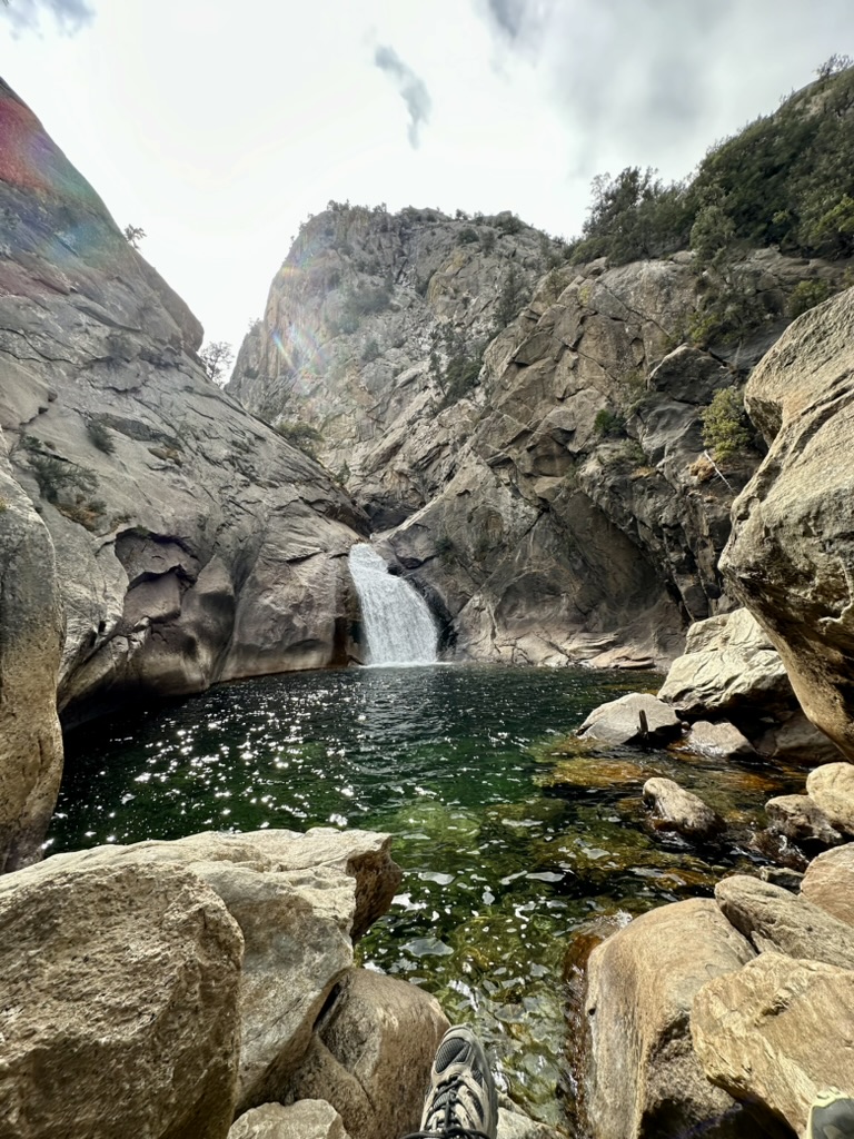
At camp everything seemed to be functioning fine. Mark worked on his motorcycle while I read a book. Later we took a walk to the creek and spent about an hour sitting by the water. I read while Mark hiked up the South Fork Mineral Creek where he found an awesome waterfall area. Later we fixed pizza in the Dutch oven on the camp stove outside. We sat outside quite a while enjoying the cool weather and scenery.

Figure 20. Waterfall along the South Fork Mineral Creek.

Friday morning Mark made pancakes and then we hiked up to the waterfall that he had found. Behind it were several more waterfalls in the gorgeous mountain stream. We walked along the stream and steep cliffs as far as we could, then cut out to the road. The road wound through a large meadow and was all uphill. We walked down to the stream through the meadow’s corn lily, asters, and grasses. However, it was too rugged without a good path and several bear droppings. So, we went back up to the road and hiked up, up, up until it seemed too far to walk. The walk back down was easier and pretty to see the meadow and mountains around us. Back at camp Mark made grilled cheese and soup for lunch. 

Figure 21. Meadow area along South Fork Mineral Creek and Road.

It was a great last day at South Mineral Campground. Later that afternoon, we walked up the creek adjacent to the road for quite a ways then back to our camper. The views there were incredible. As we walked, I regretted that we only had one more night, but then I had a feeling that I wasn’t completely leaving. I wondered if part of us -  our essence and vibes - would remain there and merge into the mountain magic. We also take some of the mountain’s magic with us as it continues to send us peace and hope when we need it most. I felt like I was part of that environment and that I could return any time in my mind.

Figure 22. South Mineral Creek.

We awoke Sunday morning to 39-degree temperatures. After coffee and oatmeal, we left that magical mountain retreat. As we headed toward home, we reminisced about past trips along that route and what we had done. Tyler and I had been to Chimney Rock National Monument, so since we were going right past it, we stopped for Mark to see it too (See Botanical Journey's book on Amazon). It now had a new visitor center and bookstore. We unhooked the trailer and drove to the upper parking lot to hike the interpretive trail. Such amazing views, history, culture, and stories in that place.

Figure 23. Chimney Rock National Monument.

That night we lucked out again and got a first come, first served national forest camp site in the Park Creek Campground. It was located adjacent to the south fork of the Rio Grande River just past Wolf Creek Pass. Site #12 was another gorgeous spot at the end of the campground with access to the river. We enjoyed our evening though I didn't sleep very well. 

Figure 24. South Fork of the Rio Grande River adjacent to our campsite at Park Creek Campground.

Monday morning, we left early and drove all day to Sand Hills State Park in Hutchinson, Kansas again. It was very hot there, so we stayed inside the camper van after setting up. Tuesday, we drove all the way home, arriving about 5:00 p.m. It is always good to be home, but we missed the mountain air and views. We will return and hopefully next time Mark can ride his motorcycle on more mountain passes, while I explore more of the breathtaking mountain magic.

Figure 25. Mark's view while riding the Colorado mountain passes on his motorcycle.


Wednesday, November 6, 2024

Exploring Magical Giants... 2024 Fall Journey Part 2

We journeyed to see the biggest trees, deepest canyons, tallest mountain, and lowest place in America. All were giants in their own magical way. We were already on a high from our Joshua Tree Yoga Retreat and the next portion of our adventure escalated those feelings of bliss in nature. 

Mark among giants at Sequoia National Park. 

After Joshua Tree we stayed one night at Paradise Cove Campground near Lake Isabella. The lake was low, and the area was very dry, so there was a fire ban. There were only a couple other campers there. Across the lake were rolling hills and mountains of sandy brown in front and dark grey behind. The next morning, we took our time getting around, watching the sun come up to light up the hills all around us. We were also back to our usual oatmeal and toast instead of Zach's great breakfasts that we enjoyed so much during the Joshua Tree Yoga Retreat (See 2024 Fall Journey Part 1).

The GPS took us on a roundabout, long road to Kings Canyon National Park. We're not sure we took the best route, but it was picturesque with very little traffic. We ended up winding up and around mountains that were often treeless and covered with dry straw-colored grasses. A few areas were black from fire. One section narrowed into one lane with a steep drop off. It started to remind me of Black Canyon Road or another one we did wintering in Morro Bay in 2021. As we entered Kings Canyon National Park, we kept stopping to see the canyon views on the way to our campground.  

Figure 1. Driving along Dry Creek Road near Badger, California.

We camped four nights in Kings Canyon National Park’s Sentinel campground, site 48. Our site was on a corner and Mark had to back in the wrong way so that our sliding door faced the picnic area. At first it seemed like a bad spot, but it grew on us with time. There were many empty sites in the campground, and we wondered if at the end of the season they only opened a few that are close to each other. When we arrived, we walked to the visitor center and to the lodge which were all closed for the season. That first night we didn't have a signal, we didn't have a map, and we were really wondering what we were going to do for five days. 

That opinion changed quickly the next day. It started with a scenic drive to General Grants Visitor Center, which was an hour away from our camp. Kings Canyon’s views were spectacular that morning with the rising sun shining on its cliffs. There were wow moments around every curve along the steep winding road. We seemed to cling to the canyon wall on one side and teeter on a deep crevice on the other.  


Video driving through Kings Canyon National Park.

At the visitor center we got maps, talked to a ranger, and found out that there is a lot to do there. Joined with Sequoia National Park, they are many faceted with both giant sequoia trees and the deep canyons. We watched a movie about the parks, and it choked me up a bit as I started thinking about the big trees that these parks protect. We bought a box of firewood at Grant General store. I also bought some poppy earrings at the visitor center and Mark got a sticker. We made coffee in the van and drank it on the cafe patio in the warm sun as we studied maps before hiking.

Soon the magic of Kings Canyon was all around me and I was so glad that we were there. We drove to General Grants Tree and hiked all around it. Grant is the third largest, by volume, tree in the world, though there were many large trees there.  

Figure 2. General Grant sequoia tree in Kings Canyon National Park.

One tree fell in the 1800s and was hollowed out to walk through. That monarch tree had a big history all the way back to when the calvary camped inside it, protecting the park in its early days from loggers and sheep herders. As I walked out of that monarch tree I really got choked up. The power from the trees was strong and all inspiring. 

We drove closer to the North Fork Trailhead and had lunch in the van. There were so few people that time of year that it was easy to park. After lunch, we walked along the North Fork Trail into Grants Grove. Part of Grants Grove had burned in recent years, but new trees were sprouting under the charred beasts. We saw blue elderberry and gooseberry there. Most wildflowers were long dried up from the late summer heat. Yet, with night’s dipping into the 30s, snow was not far away. Snow that brings life sustaining water back to the plants. As we entered the trail, I was astonished by the size of the sugar pinecones. They are humongous at 12 to 18 inches long. Next to the sugar pinecone was a small 1½- to 2-inch cone of the giant Sequoia. Such contrasting sizing and longevity in the DNA of those two cones, though they are both large trees.  

Figure 3. Mark holding sugar pinecone.
Mark spotted a bird as we hiked. I tried to zoom in with my camera and at first thought it was a knot. Mark said, “It is not a knot.” Soon I realized it was a little owl about 7 to 8 inches tall with a round head and bright yellow eyes. We got close and got some good pictures. Later I identified it as a northern pygmy owl. 

Figure 4. Northern Pygmy Owl.

That trail was great because we got up close and personal with the large trees. We could hug them and stand in them and feel their soft outer thick bark. We were respectful and appreciative since the majestic large trees are ecologically very sensitive. They are incredible. As John Muir said, “No other tree in the world...had looked down on so many centuries as the Sequoia, or open such impressive and suggestive views into history.”1

On the drive back towards camp we stopped at Hume Lake to get gas. Mark also bought a 2-day fishing license. That area had a gorgeous little lake with a Christian camp. There were many kids there kayaking and playing. They lined up to use payphones by the store. The store was quite well stocked. On our way back to our camp we pulled into the Convict Campground and walked around a little. We found some firewood in a firepit, but it was too buggy to stay there long.

With our newly purchased firewood, it was nice to have a campfire again. Our neighbors brought Mark some thin beef strips they'd cooked. The first day they said they saw a bear on the road by our camp. We never did see a bear though we are careful when in bear country. Our other neighbors were an elderly couple with lots of supplies. They seemed busy all the time, cutting wood and cooking. We called them Ruth and Meryl. Across from us was a large campsite with a small camper. A white truck pulled in late each evening and left early each morning, and we wondered if he was a worker or a firefighter. 

Figure 5. Our campsite at Sentinel Campground in Kings Canyon National Park.

On Thursday, October 24th,  we stayed in King Canyon’s Cedar Grove area by our campground to explore. It was quite cold that morning, so I stewed apples into oatmeal, and we took hot showers. Our first hike of the day was a chilly, yet spectacular one, to the Zumwalt Meadows. Most of the trail washed out a few years ago in a flood. Still, from the alternate rocky boulder trail we caught glimpses of the greener meadow surrounded by cattails, horsetails, and trees. Tall white fir, ponderosa pine, fall colored yellow and orange ferns, and yellowing mountain maple and willows filled in between. So many colors spread across the meadow, backdropped by a sheer cliff of white granite. Mark said it was an outstanding hike. 

Figure 6. Zumwalt Meadows in Kings Canyon National Park.

At the Roads End area past our campground, we parked and walked out to Muir’s Rock along the river. John gave many speeches there to save the trees and canyon. I could almost picture him sitting on the rock admiring the canyon all around. Mark saw some fish in the deep pool and got the itch to go fishing. 

Figure 7. Mark standing on Muir Rock at Kings Canyon National Park.

We hiked short walks to a couple swift running waterfalls in the area. Grizzly Falls was the tallest, yet swift River Falls was most unique. Swift River Falls fell in through rock crevices into a perfectly round, deep pool of water surrounded by large boulders. The water was a clear emerald green. We wondered if there was copper in the water. 

Figure 8. Swift River Falls with its emerald green pool.

We ended the day sitting along the river. We parked our van along the river, I fixed soup and grilled cheese in the van, and then we walked to enjoy the river’s serenity and beauty. Mark fished downstream while I sat on a rock journaling. A helicopter kept flying over and firefighters were nearby as they fought and monitor recent forest fires. Smoke still lingered in blackened areas along the road. It was a lovely afternoon but too soon the sun started to dip behind the cliffs behind us and the evening cold crept in. 

Back at camp Mark soon had a fire roaring. We had new neighbors on one side, but Merle and Ruth were still there. Gathering firewood is legal in this park, so we picked up some driftwood and big pieces of bark at the river. The bark was amazing how it barely burned. It really helped tell the story of how the Sequoia trees with two-foot-thick bark could withstand so many fires. We made chili and hot dogs on the fire and stayed out to see a few stars.

On Friday, October 25, we had a great day walking among the giant Sequoia trees in the adjacent Sequoia National Park. It was a long drive from our campground to those groves, so we got up early, had coffee and hit the road as soon as it was light. We stopped at the Grants area for breakfast, then drove mostly right to General Sherman – the largest tree in the world. As soon as we pulled into the General Sherman Tree parking lot, the number of people exploded. It is the most popular spot and attracts peoples from around the world. We heard multiples languages as families and friends enjoyed the area together. General Sherman looked like it did when we were last there 18 years ago. We took pictures to compare then and now. It is a massive tree, though it feels more feminine matriarch than a masculine general to me. From there, we walked about a half mile down a trail to see more trees than back up to the half mile steep path to our van. 

Figure 9. Rhonda with General Sherman
sequoia in 2024.

Figure 10. Rhonda with General Sherman
sequoia in 2007.

We drove to the Giant Forest area and its museum, which were named by John Muir. It was the same building with the same giant Sentinel tree in the front we had seen before. The inside exhibits were newer and very well done. One showed where the Groves were in the various parks and how many trees were greater than 10-foot in diameter. They're so few really, and I am so glad we are protecting them. Another exhibit showed their heights compared to the statue of liberty and other trees. It also showed the oldest tree in the world, the bristlecone pine that lives nearby in the White Mountains. I took a picture of Muir’s quote again that I love, “In every walk in nature, one receives more than he seeks.” His words are still true today and forever more. On the long two hour drive back to camp through the Sierra mountains, we stopped at a few vista points.  

Figure 11. Rhonda getting passport stamp for Sequoia National Park.

We had a great final evening in King's Canyon enjoying the serenity and peace while cooking a perfect campfire pizza. We had such perfect weather while we were there. Nights fell into the high 30s but warmed back into the high 60s during the day. Bright blue skies shone above the various types of tall evergreen trees surrounding us. I could hear the roar of the river across the camp. It was peaceful there in the Sierras. What a wonderful place. 

On Saturday, October 26, we moved to Yosemite. It was a long drive, and by the time we got to our campground, we felt like we had been in the van for a very long time. We drove through gorgeous mountain with outstanding views. Near Fresno in California’s Central Valley, we got gas and called the boys, then both then did some social media posts while we had cell service.

At Yosemite we drove right to the Mariposa Grove where we had to park and ride a shuttle to the grove. We were in Yosemite part of a day in 2017, but the Mariposa Grove was closed for renovations, so I wanted to see it.2 It felt good to walk around the loop to the Grizzly Tree. What another great tree. It was not as large as others we’d seen, but I found it quite beautiful. It was symmetrical, with more big branches surrounding the tree. Although all sequoias begin in a symmetrical Christmas tree spire shape, they typically change to more open, uneven canopies in their monarch life stage as branches are damaged by fire and storms.  

Figure 12. Grizzly sequoia tree in standing proud and tall in the middle of the Mariposa Grove.

Just past the Grizzly tree was the California Tunnel Tree. It was alive with its hole that was cut in 1895 to allow horsedrawn stages to pass through it. Back at the welcome center and our van, we asked a ranger for hiking suggestions while we were there. She suggested the drive up to Glacier Point and told us that Tioga Road would close Sunday at 6:00 p.m. for expected snow. We had planned to stay there two nights, but that closing changed our plans. 

So, we decided to do the Glacier Point drive before finding our campground. It was a long drive and again well worth it. As soon as we turned a corner near the top and saw the Half Dome rock, Mark said, “Wow, that's impressive and awesome.” We parked and walked to the point where we could see waterfalls and rocks and scenes from above. The only thing we couldn't see from there was El Capitan. However, that famous rock was quickly visible as we drove back down into the valley. Such an amazing place to see. 

Figure 13. Rhonda enjoying the view from Yosemite's Glacier Point of Half Dome.

We drove to our campsite in Hodgson meadows, site 62. The campground was sprawling with many sites. Ours was somewhat hilly so we used blocks under the van wheels. Mark scrounged some firewood, and we cooked burgers on the fire. We had a different site for the next night in the same campground but decided to forfeit it because they were closing Tioga Road. We really wanted to drive Tioga Road out of the park to prevent the long roundabouts and see its awesome views.

 So, on Sunday, after showers and breakfast, we headed towards Tioga Pass. It was worth it to forfeit the nights campsite to drive that scenic road across the Sierras. We stopped at several waypoints to look at views and read signs. Many had signage about trees and geology. I was impressed with the tall red fir (Abies magnifica) trees up there with their deeply furrowed red bark silvery colored needles. The most abundant tree up there were the Lodgepole Pines (Pinus contorta ssp. murrayana). We stopped at Olmsted's viewpoint to see Half Dome from the backside. There are so many giant domes and massive rocks up there. The views in the valley go on and on, interrupted only by fluorescent yellow fall-colored trees, possibly aspen, cottonwood, or willow, in the valley. 

Figure 14. Olmstead Viewpoint on Yosemite's Tioga Pass Road where Half Dome is visible from the other side (shown in center back).

We sat several minutes by Tanaya Lake. Alpine lakes have such primal beauty, tucked between mountain peaks that feed them and keep them clear and pristine. There is an energy in the air there, almost like others that came before me sat on the same rock and felt nature's peace in the same way. Somehow the prana of ancient, current, and future peoples milled together there, extending the power of that place forever. Such a privilege to add my vibes to that special place.  

Figure 15. Yosemite's Tanaya Lake.

Past the Tioga Pass entrance gate, we sat at an overlook and had lunch in the van. The wind was fierce and reminded me that soon snow would cover the hills and valley around me. From there we drove out and down Highway 395. Wind seemed to whip the steering wheel out of Mark's hands at times, but it was a pretty drive between the White Mountains and the Sierra Nevada Mountains. We contemplated turning to go see the ancient bristlecone pines in the White Mountains but ventured on instead.

Where I had phone service, I chose Tuttle Creek campground as our next destination for the night. It was near Highway 395, but there was a detour to get back to the campground. The detour road was narrow and wound around huge boulders that reminded us of Joshua tree. It was awesome! Once there, we chose site 13 with a view of Mt Whitney to the west and White Mountains to the east. A gem of a site. 

We really enjoyed Tuttle Creek Campground. We made potatoes and burgers on the campfire and watched a few stars come out, which was such an amazing sight between the mountains. Monday morning I climbed the van’s ladder and sat on the edge of the van to watch the sunrise. It was cold, but so worth it. I saw the visible sliver of Mt. Whitney glow first as it turned slight yellow. Soon it blazed in golden light as other peaks joined in the chorus. Within minutes the entire desert in front and around me glowed in golden morning sunshine. I laughed out loud with glee as it progressed. Such a magical sight to see. One that I’ll remember forever. 

Figure 16. Sunrise at Tuttle Creek Campground.

We took the same scenic, twisty road out and it was just as glorious, only with morning sun instead of evening shadows. Death Valley National Park was on the way, so we headed there. We drove across the entire park from west to east, which takes a long time. It is the largest park in the lower 48. As often is the case, it surprised me. I think I expected an expanse of hot sand with a few plants. Instead, we encountered deep canyons where fighter jets train, deep sand dunes with stunted Mesquite trees, and winding roads up and down through boulders and cliffs. At the visitor center we looked around and got some souvenirs and my passport stamp. The exhibits discussed borax mining and deadly pioneer treks. A rare fish lives deep in waters beneath the table salt covered, evaporated lakes.

We drove to the Bad Water Basin at 282-feet below sea level and walked across the salt flat to see the crested salt lines. Holes here and there showed that water lurked just below the surface. It was 90°, hot, dry, and windy there. So harsh, yet a couple plants still grew.  

Figure 17. Death Valley National Park's Bad Water Basin at 282-feet below sea level.

On the way back out, we drove through the Artist Palette that snaked through large rocks of varying colors, shapes, sizes, and textures.  

Figure 18. Drive through Death Valley National Park's Artist Palette.

We spent our last night in the Virgin River Recreation Area Campground in northwest Arizona, just north of the Grand Canyon. Also adjacent to the Colorado River, it had similar features to the Grand Canyon. The Interstate from Las Vegas to there was quite scenic as we drove through massive towers of rocks where the Colorado River flowed. Such an amazing area. At first we had a little trouble figuring out the National Forest QR code reservation system but finally found and reserved a perfect spot by the river with a view of the cliffs. Site 95 in the lower loop was a pull off with a table and a fire pit. Mark started a fire, but we soon realized it was too windy for a fire, so we just sat outside and watched the darkening sky light up with stars, planets, and the Milky Way. Another magical evening in the West.  

Figure 19. View from our campsite at Virgin River Campground.

It rained in the night, which was the first rain of our trip. The next day we drove off and on through snow showers to our next stop. The drive across Utah was quite scenic with varying views of mountains, rocks, and valleys. We listened to John Muir’s Our National Parks book and wished we'd listened to it before visiting Yosemite, Sequoia, and Kings Canyon National Parks. He is so descriptive, and we felt a bit like the “Thousands of tired, nerve-shake, over-civilized people beginning to find out that going to the mountains is going home.”3 

At a scenic pull off in Utah, I made grilled cheese sandwiches, and we reserved a spot at the KOA in Glenwood Springs for that night. It was more expensive than the last night at Virgin River at $60 versus $8 but it had amenities and was quite comfortable. It was too cold to be outside anyway.

We stayed Tuesday night in Oakley, Kansas at the High Plains RV spot. They also had a Grub and Chug Café, so we had a supper of salad and pizza that night. They had DVDs to borrow so we watched City Slickers that night and I laughed and laughed. The next morning, we drove south to the Monument Rocks so Mark could see them. We drove past Buffalo Bills large statues at his Cultural Center. It is all impressive and gave me many memories of being there with family in 2021.  

Figure 20. Mark standing under part of Monument Rocks in Kansas.

We spent our final evening in Missouri at Pershing State Park in our usual corner spot. Mark quickly got a fire going and we sat outside in the autumn splendor eating hotdogs and chili. The mature oaks all around us created a kaleidoscope of colored leaves above our heads and beneath our feet. We heard squirrels chattering and gathering nuts. Coyotes howled down the hill. Such a perfect, pleasant last evening on our trip.

As we reminisced about our journey that last day, Mark said, “We’ve had lots of pretty!” I answered, “That we have. Wow! That we have!” Of course more “pretty” greeted us as our yellow gingko and Autumn Glory maple trees greeted when as we drove into our driveway. 

Figure 21. Fall colored trees welcomed us home.

__________________
1-Muir, John. (1894). The Mountains of California, page 182.
2-Ferree, Rhonda (2024). Botanical Journeys...Exploring Nature's Wonders in our Retirement Adventures, page 65.
3-Muir, John. (1901). Our National Parks, page 1.


Tuesday, November 5, 2024

Joshua Tree Yoga Retreat... 2024 Fall Journey Part 1

The main purpose of our 2024 fall journey was a yoga retreat at Joshua Tree National Park with Bigger Life Adventures. It was my fourth retreat with them, Mark’s first, and having Mark join me for it was special. We signed up right after we purchased our new camper van in the spring. The van fit into the retreat’s camping format well and we were both intrigued by the rock-climbing adventure portion.

Astrid and Rhonda's Joshua Tree Poses at Joshua Tree National Park.
 Photo by Carrie. 

We left our home on Sunday, October 13, 2024, several days before the retreat began. As retirees, we like to travel slow and find adventures along the way. This time we drove two long days, staying one night in El Dorado State Park’s Oak campground near Wichita, Kansas and another night in New Mexico at Santa Rosa Lake’s Rocky Point Campground. Both locations had ample space, but navigating their reservation systems was challenging. One had a self-pay kiosk and another an online system. I had to climb our van’s ladder to get enough signal to complete the Santa Rosa reservation. Mark laughed at me for that. 

Experiencing Sedona’s Vortex Energy

We traveled harder those two days so that we could spend some time in Sedona, Arizona before the retreat in California. We didn’t have a reservation in Sedona so took a gamble at the first-come, first-served sites at the Forest Service’s Pine Flat Campground. Luck was on our side, and we got there just in time to secure one of the last spots. We stayed there two nights and enjoyed it very much. 

The first night (Wednesday, October 16, 2024) we sat under the van’s awning during a short rain shower, then made pizza on the campfire. It was so nice to have a campfire again for warmth and ambiance. Many places had a fire ban but in the valley along Oak Creek, we were allowed fires in the campground.

Since we stayed two nights, we had a whole day to leisurely explore the area. We got up early, had coffee and oatmeal, then drove down scenic Highway 89A as the sun came up, spotlighting the cliffs all around us. It was such a pretty drive. Sedona is a fancy, touristy town. We drove through it to the Bell Rock Trailhead and got the last open parking spot. We had to remove the Yakima storage box at the end of our van and place it on the ground in the front of the van to fit into the parking space.

We hiked up to Bell Rock, then to the right around its base, climbing midway up and along a ridge. At one area a lady came through and said it was scary but doable, though it was her first hike. We scrambled over and through to the other side, then around and over to a flat rock area in the shade. There we sat to reflect silently and soak in the vortex energy that is found there. 

Figure 1. Bell Rock in Sedona, Arizona.

Sedona has many vortexes, which are thought to be swirling centers of Earth’s energy conducive to healing, meditation, and self-reflection. Many people feel inspired and alive with energy after visiting a vortex site. I closed my eyes and soaked up the vortex’s energy. It was subtle but I felt slight tingles in my hands and neck. As I let go, I felt my inner child and inner mentor (older self) merge into the present moment. They were both with me there in that magical setting and I felt at peace, calm, and happy.

The next vortex was at the airport. There was ample parking there for a $3 fee and a lookout area across the street. We hiked from the lookout area down to the Airport Mesa vortex. About halfway there I felt the vortex as my hands and neck slightly tingled. We climbed on top of the mesa and sat a long time. On the less windy side I felt such calm energy. I think the Airport Mesa vortex was more yin-like than the Bell Rocks yang-like energy. To me they felt different. 

Figure 2. View from the Airport Mesa in Sedona, Arizona.

Back at camp we walked across the highway to the other campground. We were on the first come-first served side and the campsites across the road by the creek were all reservable. We walked along the rocky creek a bit. It didn’t have much water, but we did see a small fish and a wren bird. 

Joshua Tree Yoga Retreat Arrival

The next morning, we drove from Sedona to our Joshua Tree Yoga Retreat, arriving on Thursday, October 18 about 3:00 p.m. Carrie met us, and we parked our van. The camping area was along a sandy road with lots of little desert plants spread out down a long, narrow area. Beside us was a rocky hill where a few guest’s tents were pitched. Beyond that was a large boulder hillside which led into the national park.  

Figure 3. Joshua Tree Yoga Retreat Campground.

We leveled the van and unpacked a little then went to meet old and new friends.  It was a Costa Rica Retreat reunion of sorts, since six of us had been there too in February. At 4:00 p.m. we had an open circle to introduce ourselves and orient to the place and retreat schedule. I said my intention for this retreat was to “Live in each moment,” and I feel like I did that. After circle, we had yoga for about an hour in a circular open area in the sand. I enjoyed it and found parts were challenging, probably from the unlevel sandy surface and tightness from driving and hiking in Sedona. After yoga we had supper. Zach made pumpkin curry over rice, which was very tasty and filling.

Later Carrie and Zach’s assistant Astrid lit a campfire, and we all sat around and talked until about 10:00 p.m. Zach brought out smore ingredients with vegan marshmallows, Lindt chocolate, and graham crackers. Mark made one and I had a bite. Astrid had us play a game of highs and lows. We each said our high and low for that day. I said my low was camper maintenance at Loves where we had our propane filled and did the typical dumps and fills. The high was when I came out of our camper for supper and turned around at the food tent to see the bright, splendid, full moon rising over our van and the hills in the distance. The moon was so bright that we didn't need lights to get around after dark. The stars were not as brilliant, but oh that moon! It was a fun evening around a blazing fire with new and old friends. A perfect start to our retreat.

Figure 4. Full moon over our camper van at Joshua Tree Yoga Retreat.

We slept well in our comfortable van, running the heater a little in the cool, desert night. We got up about 6:00 a.m. and made coffee in our van. I climbed the rocky hill beside us for the morning sunrise meditation at 6:45 a.m. It was only Carrie and me for most of it until another guest joined us later. It was a very cool morning so I'm sure most people stayed in their warm tents until breakfast. Zach made oatmeal with apples and nut butter for breakfast. He also made us all a sack lunch of tofu po’boys and fruit, which was very tasty at noon when we were rock climbing.

Facing Fears to Climb Rocks at Joshua Tree National Park

We waited an extra hour before going to the park to rock climb since it was so cold and windy that day. Our professional climbing guide Amylee and her daughter went ahead to set up some ropes. She had one set above and scrambled up to set another one once we got there. We walked about 10 minutes through the Real Hidden Valley of Joshua Tree National Park to an area called Thin Wall. It is a rock formation that is narrow yet tall to climb and easier for the guides to scramble at the end to set anchors and ropes from above. At the bottom Carrie and Astrid showed us how to attach the rope to our climbing harness. Amylee provided us all with a harness, shoes, and helmet.

Clark* was the first to climb and he made it look so easy, climbing all the way to the top then repelling back down. Mark went second. He made it up the first tier then decided the sheer cliff second tier portion was more than he wanted to tackle at that time. 

Figure 5. Mark Rock Climbing! Photo by Carrie.

I went next and climbed a body length higher than Mark but not all the way. It was harder than I expected and scarier at first. Coming down is my favorite part when you sit in the harness and hop down while the belayer below slacks the rope. 

After a lunch break and watching the others climb, I tried the other rope that they said was easier. It was easier but I also trusted my equipment better that time. I climbed three quarters of the sheer cliff portion and probably could have went the whole way. I was happy with that. At one point as I rested in my harness, I looked behind me and yelled, “Wow! Look at that view!” They all laughed. I loved that. I went a little higher after that then rappelled back down, satisfied with my climb. Such a fun time. As RUSH’s Neil Peart said in his book Travelling Show that we listened to on this trip, “Fear plus survival equals fun.” He is so right!

Figure 6. Rhonda looking at view behind her while rock climbing.

Retreat Yoga, Food, and Fun

We did yoga most mornings and evenings during the retreat. Carrie (and Astrid one morning) led us in energizing morning sessions to start our day. Evening sessions were long yin holds that felt good to stretch out sore muscles from that day’s climbing or hiking.

Figure 7. Morning yoga at Joshua Tree Camp. Photo by Astrid.

People sometimes say that they go on Bigger Life Adventure retreats for Carrie’s yoga and return for Zach’s vegan food. To me they are equally excellent reasons to do their retreats. Zach’s food never disappoints and always surprises me. I couldn’t wait for Mark to try it, and he too was impressed. He especially liked the taco night. We had a supper of mushroom spaghetti one night and Tempe with cranberry sauce, beans, kale, and fruit another. Though hard to choose, my favorite this time was a breakfast of avocado toast and tofu scramble using black salt, a form of Himalayan pink salt with sulfur added that gave it an egg taste. Zach just published a new cookbook, Plants on Plates, and he brought me my preordered, signed copy. We can’t wait to try some of his recipes, though I’m not sure we will make them as well as him. 

Figure 8. Zach's new cookbook is available at Bigger Life Adventures. Photo by Astrid. 

Each night we had fun around a roaring campfire and laughed hard. Friday night Zach had his guitar, so I played and sang two Kris Kristofferson songs and Zach played fun songs. The girls were so fun and crazy. It was such a great group. The last night someone suggested we play a story game where we each said one word as we went around to build a story. It was fun and got weirdly crazy. We laughed and laughed, which felt good. 

Figure 9. Laughing around the campfire. Photo by Astrid. 

Bigger Life Adventures always include some free time. On our free day, Mark and I drove our van into Joshua Tree National Park from the west entrance by our campground all the way to the Cottonwood entrance. It’s a long drive. At the end, we hiked to the Cottonwood Spring and on the Mastodon Peak Trail. Both were perfect with just enough challenge on a warm day. The spring had an oasis of fan palms and cottonwood trees, which are such a contrast to the dry desert plants all around. Birds flew in and out of the palms and sang.

Figure 10. Cottonwood Spring Oasis at Joshua Tree National Park.

The Mastodon trail was a two-mile loop through big boulders, up and down small sandy hills, across desert scrub, and up to Mastodon Peak. At the peak area we had to scramble up boulders for an amazing, though windy, 360° view of the area. Far below we could see the Salton Sea. It was a bit scary to scramble near the top, but Mark persevered, and I followed. I'm so glad we did. It was a great view and a place to rest before coming back down and hiking back to the van. 

Figure 11. Windy selfie from Mastodon Peak at Joshua Tree National Park.

Along the way back, there was another oasis with fan palms, cottonwood, and some eucalyptus trees along a dry riverbed. At the van, we ate chickpea salad wraps that Zach made us for lunch. Back at the west entrance there was a long line to show our passes to exit. Mark somehow dropped our National Park Pass out the window and had to get out and climb under the van on the ground to find it. I laughed till I cried. As we sat in line, he was upset that they made him wait to leave, then he held everyone else up behind us. Another fun moment on this trip.

Sunday was our Sound Bath Day. Before our session, Mark and I spent a few hours in town. We went to a few artsy stores, the World Famous Crochet Museum, and walked around. At the Sole Connection store, the owner Dawn asked us where we were from and her eyes lit up when I said Havana, Illinois. She is best friends with one of our best friends. That was so fun. The sound bath was in a special, unique place called the Integratron. It is an amazing place built for perfect acoustics in a comfortable setting. We laid on soft mats and a lady played quartz crystal singing bowls for almost an hour. They were loud and their vibrations filled us with waves of peace and relaxation. I'm sure I dozed off a few times. I didn't have any revelations during the session, though I sure was relaxed afterwards. 

Figure 12. Integratron. Photo by Astrid. 

From there we drove to a nearby giant rock said to be the largest freestanding rock in the world at four stories tall. It was a long three-mile, sandy dirt road to get there and I freaked out a bit, losing all my sound bath zen along the way. Still, it was neat to see. 

Figure 13. Mark "holding up" the Giant Rock.

Magical Moments During Yoga Retreat

During the retreat, Carrie led us in a mantra building exercise. My mantra was “Adventures in nature fuel my soul.” That came true many times. During one morning yoga session, Carrie led us in stretches and through an energetic flow. We ended with the Wim Hof Method breath technique that we repeated three times. The third time I remembered that when we did that same technique in Costa Rica, I saw myself dancing in a flower field with my inner mentor that I call White Clover. This time my inner child joined my inner mentor, and I saw lots of Rhonda’s of various ages dancing in the flowers. What fun! During the breath work I inhaled fun, exhaled fear, and ended up dancing in a field of flowers. 

The morning sunrise meditations were equally magical. I loved sitting high on the rocks and watching as the landscape around me woke up with the rising sun. It was so quiet, and I heard the wings of a bird fly past me. I felt renewed each morning as the sun rose, cleansed, and woke up the world. The plants soaked up the rays and released calming vibes and cleansing life oxygen. I loved sharing their world. The desert plants have such diversity and colors there. It is so very different from tropical settings or our own back yard, yet in some ways it was more peaceful. The desert plants were spread out and seemed to coexist, helping each other in the harsh environment. Yes, they had sharp spines, but those helped them conserve water as modified leaves and stems. Each plant’s texture, shape, and size stood out across the landscape in unique and special ways.

Figure 14. Rhonda's morning meditation at Joshua Tree National Park. Photo by Lisa. 

Our retreat closed with an evening Cacao Ceremony and a morning closing circle. After Sunday’s supper we moved to the fire and had our Cacao Ceremony. Zach served us a homemade chocolate drink made of Zimbabwe cacao and talked about its importance and symbolism. Astrid led us in some dancing around the fire that felt free and fun. We had a lot more laughs that night. 

After yoga the next morning, we had our closing circle where we revealed our secret missions, any takeaways, and everyone gave one word to describe each person. They described me as fun, wise, knowledgeable and such as that, which always makes me feel good. They said Mark was brave, interesting, and fun. On the first day, Carrie gave us each a secret mission to fulfill during the retreat. Mark gave Clark a copy of my book Botanical Journeys to fulfill his secret mission of giving someone a gift. I signed it, which completed my secret mission to give someone a note of encouragement. Mark said Clark was very moved by the gift and we hope it inspires him to do more adventures of his own. He later did a card trick with us and taught us how to do it, completing his secret mission to teach somebody something new. Afterwards, Zach made sweet potato pancakes for breakfast with some oatmeal and fruit. We all packed and said our goodbyes. I gave Astrid a yoga mat and bottle holder I crocheted. I also gave Carrie and Zach a copy of my book.  

As we left Joshua Tree, I was high on the positive vibes and love from all my adventures with friends in a magical place. I felt like I really relaxed and settled into the space, retreat, and people this time. On the last day, a song played during our pranayama that mentioned our past, present, and future selves reminding me of the Rhonda's dancing in the flowers. It also said that friends come and go, and new ones are waiting for us. That was comforting and so true. I've made great new friends on these retreats and that is a big reason why I do them. I say I do them for the yoga and self-reflection, but each time it is the people that fuel my soul and assure I have a Bigger Life Adventure.

Figure 15. Rhonda and Mark relaxing in Joshua Tree National Park as they watch friends climb Thin Wall. Photo by Astrid. 

Note: Check out Bigger Life Adventure upcoming retreats on their website and social media sites. Retreats fill quickly so reserve your space today. 

*Some names omitted or changed to protect privacy.